
Tag "RADAR"
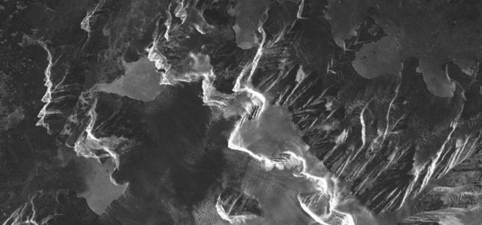
Safer Seafaring with Satellites – DLR Produces Radar Images at Its Antarctic Station in Near Real Time
Sailing in the regions that polar researcher Arved Fuchs is currently navigating in his ship ‘Dagmar Aaen’ is a not an easy task. The ‘Ocean Change’ expedition is travelling around
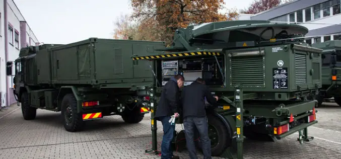
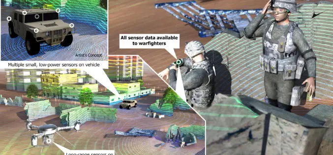
Airbus Defence and Space Completes First Mobile General Ground Station for NATO’s Alliance Ground Surveillance
Airbus Defence and Space has completed the first of its newly developed mobile general ground stations (MGGS) for the NATO’s Alliance Ground Surveillance (AGS). AGS is a NATO programme to
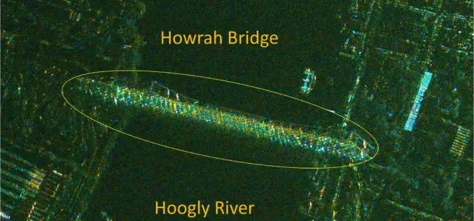
India’s RISAT-1 High Resolution SpotLight (HRS) Polarimetric Image
Indian Space Research Organization’s (ISRO) Radar Satellite-1 (RISAT-1) is a state of the art Microwave Remote Sensing Satellite carrying a Synthetic Aperture Radar (SAR) Payload operating in C-band (5.35 GHz), which

Webinar Series: DEM Extraction from SAR Imagery
Get More From Imagery Webinar Series: DEM Extraction from SAR Imagery Nov. 19, 2015 at 4am EDT (9am GMT) | Nov. 19, 2015 at 2pm EDT (7pm GMT) PCI Geomatics is the

XpressSAR: High Revisit, High Resolution, All Weather SAR Satellite Constellation
XpressSAR Inc. is an American owned and operated company. XpressSAR will be a constellation of four small Synthetic Aperture Radar (SAR satellites with an average revisit rate of less than 4

Webinar on Transition of ENVI Analytics from Desktop to Web
Webinar on Transition of ENVI Analytics from Desktop to Web Tuesday, September 15, 2015 1:30 pm Singapore Time (Singapore, GMT+08:00) Geospatial imagery is used more and more across industries because
3D Measurements of Forest Areas
A tangle of treetops and branches, through which just the occasional clear area provides glimpses of the trunks and roots growing below. Whether it is woodland with German spruces or
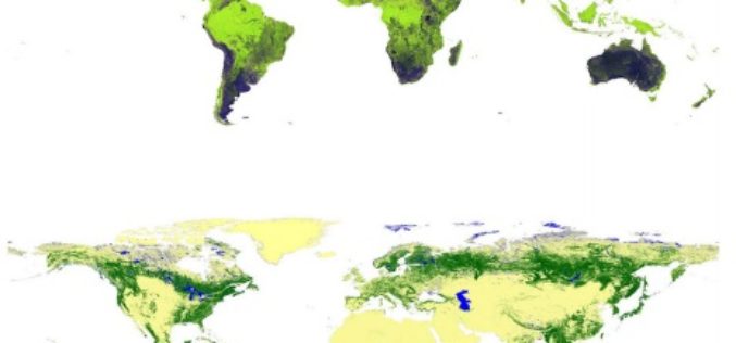
Global Forest Watch Using High Resolution Synthetic Aperture Radar
Forests always have been an important for all human beings and animals. For some forests provide shelter and some forests are source of livelihood. Monitoring global forest footprint is of
DARPA Develop Technology to Integrate LiDAR on Microchips
DARPA, American defence research agency has developed a LiDAR system small enough to be integrated on a microchip yet offering better performance than conventional bulky mechanical devices. DARPA’s Short-range Wide-field-of-view Extremely agile

NASA First Ever Mapped Greenland’s Ice Sheet in 3D
Scientists using ice-penetrating radar data collected by NASA’s Operation IceBridge and earlier airborne campaigns have built the first-ever comprehensive map of layers deep inside the Greenland Ice Sheet. This new
