
Tag "Processing"
GIS
Algorithms used in the Airborne Lidar Processing System (ALPS)
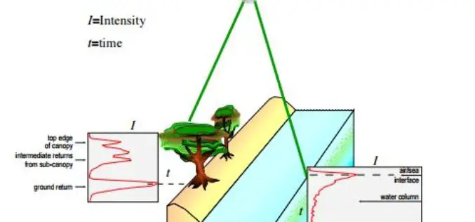
The Airborne Lidar Processing System (ALPS) analyzes Experimental Advanced Airborne Research Lidar (EAARL) data—digitized laser-return waveforms, position, and attitude data—to drive point clouds of target surfaces. A full-waveform airborne lidar
