
Tag "OpenStreetMap"

OpenStreetMap for Emergency Response
This past week was intense – the most powerful hurricane ever recorded in the Western Hemisphere made landfall, just missing major population centers and avoiding catastrophic damage. Three days later,
Using Vector tiles Facilitate Your Mapping Experiences
One of all GIS products that Supergeo Technology has been devoting to developing, implementing and promoting for the world, SuperGIS Desktop 10, is going to be launched for global users.
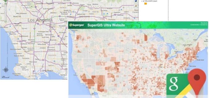
SuperGIS Server Extends Map Possibilities with Various Resources
This week, Supergeo releases the latest version of SuperGIS Server with plenty of new functions, including related tables, improved JavaScript print tool, and new JavaScript APIs supporting OGC layers. With
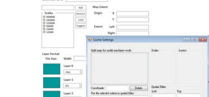
Insights to SuperGIS Server 10
Supergeo is going to upgrade all the products to a new level, the 10 series, including SuperGIS Server. The most exciting thing in SuperGIS Server 10 is its integration of
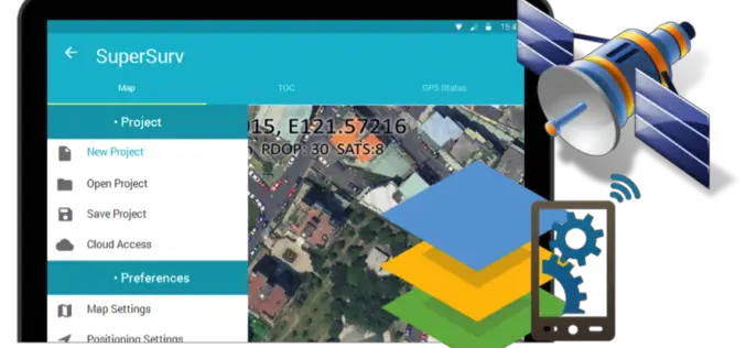
Behold! SuperSurv 10 Come for Unleashing the Power of Latest Technology in Mobile GIS
Can’t find the best fit mobile GIS solution for your field work? Wondering with all the hardcore and complicated operations in most survey Apps? Get ready to experience the brand

FOSS4G Europe 2015 Announces Two New Keynotes Speakers!
The second edition of the FOSS4G Europe Conference will be held at Politecnico di Milano in Como, Italy, from July 15th to 17th, 2015. A day of workshops will precede

Vector based Spatial Analysis using TdhGIS
TdhGIS is an open source spatial analysis tool data based on vector geometric data. TdhGIS has an open database structure and the ability to import and export common file formats, including
FOSS4G Europe Conference – First Keynotes Speakers Announcements!
The second edition of the FOSS4G Europe Conference will be held at Politecnico di Milano in Como, Italy, from July 15th to 17th, 2015. A day of workshops will precede
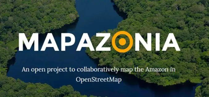
MAPAZONIA – A Crowdsourced Project to Map the Amazon
The Amazon rainforest also known in English as Amazonia or the Amazon Jungle covers most of the Amazon Basin of South America. This region includes territory belonging to nine countries: Brazil, Bolivia, peru, Ecuadoe, Colombia, Venezuela, Guyana, and
Powerful GIS Web Manager in SuperGIS Server 3.2
Supergeo, the leading GIS software and solution provider, released the newest version of SuperGIS Server 3.2 to help enterprises share diverse geospatial data effortlessly. The latest SuperGIS Server 3.2 is
