
Tag "OGC"

OGC Seeks Public Comment on Candidate OGC® Coverage Collection Extension
4 March 2016 – The membership of the Open Geospatial Consortium (OGC®) seeks public comment on the candidate OGC® Coverage Collection Extension Standard. The candidate OGC® Coverage Collection Extension Standard
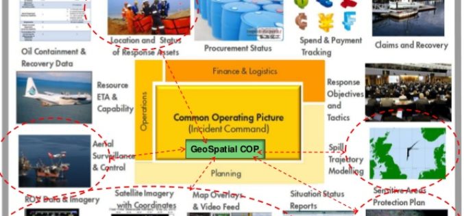
OGC announces Oil Spill Response Common Operating Picture Recommended Practice
02 March 2016: The Open Geospatial Consortium (OGC®) announces that the International Association of Oil & Gas Producers (IOGP) through the Geomatics Committee and IPIECA (the global oil and gas
OGC Requests Information to Guide Arctic Spatial Data Pilot
The Open Geospatial Consortium (OGC®) requests information to help advance the “Arctic Spatial Data Pilot”. The Arctic Spatial Data Pilot is an OGC Interoperability Program initiative sponsored by the U.S.
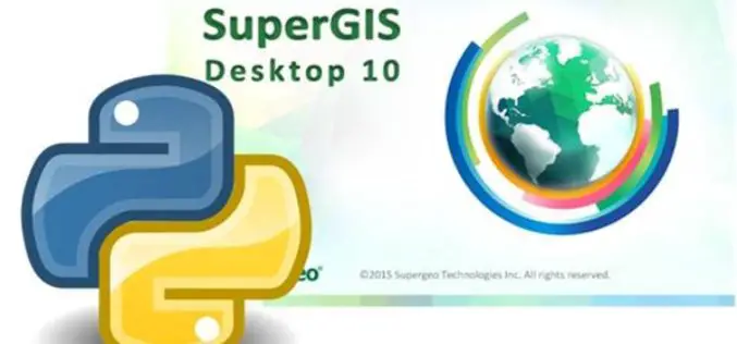
Customize your GIS platform easily with Python!
As a professional GIS work platform, SuperGIS Desktop has a variety of functions for map data management, data editing and data analyzing. SuperGIS Desktop also supports diverse databases and services
OGC Announces Simplified Web Mapping Standard
The OGC announces that the OGC membership has adopted the OGC® WMTS Simple Profile, which defines a simplified profile of the OGC Web Map Tile Service (WMTS) Interface Standard (see
OGC Seeks Public Comment on OGC Emergency and Disaster Management Information Framework Discussion Paper
The membership of the Open Geospatial Consortium (OGC®) seeks public comment on the OGC Emergency and Disaster Management Information Framework Discussion Paper. This paper proposes the establishment of information management
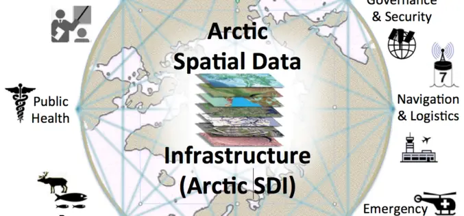
OGC Announces New Arctic Spatial Data Infrastructure Project
The Open Geospatial Consortium (OGC®) announces a new OGC Interoperability Program project called the “Arctic Spatial Data Infrastructure Standards and Communication Pilot” (Arctic SDI Pilot). The Arctic SDI Pilot is
OGC Announces Standard That Makes Complex Environmental Data Easier To Use in GIS
The membership of the Open Geospatial Consortium (OGC) has approved the OGC CF-netCDF 3.0 encoding using GML Coverage Application Schema, an extension to the OGC CF-netCDF 3.0 encoding standard. The
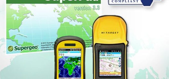
Get Ready for Best Mobile GIS Solution on Windows Mobile Platform Ever!
The product team at Supergeo is getting ready to launch an updated version of SuperPad 3.3! The usability and reliability have been improved, and we have included some robust and
OGC and ASPRS to Collaborate On Geospatial Standards; Invite Participation in Point Cloud Work
The Open Geospatial Consortium (OGC) and the American Society for Photogrammetry and Remote Sensing (ASPRS) have agreed to work together more closely in the application and promotion of standards and best practices for the
