
Tag "NRSC"
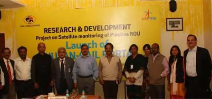
GAIL and ISRO Joins Hands for Satellite Monitoring Of Pipelines
To address pipeline safety concerns, GAIL (India) Limited in collaboration with National Remote Sensing Centre (NRSC) – a unit of Indian Space Research Organization (ISRO) – has launched an innovative
Ebook on Remote Sensing Applications
National Remote Sensing Center (NRSC) focusing on promotion of Remote Sensing Technology and Applications among users in India. The Centre is responsible for remote sensing satellite data acquisition and processing, data
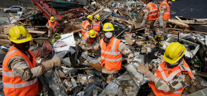
NDRF Joins Hands with ISRO to Get Real-time Satellite Data for Disaster Rescue
In a bid to obtain the vital “third eye” to tackle disasters, the National Disaster Response Force (NDRF) has inked a pact with the National Remote Sensing Centre (NRSC) which

Geospatial Technology to Assist Centre in ‘Housing for All’ Mission
New Delhi, Housing and Urban Poverty Alleviation Ministry has joined hands with National Remote Sensing Center, Hyderabad, for use of latest technologies in its Housing for All urban mission, on the
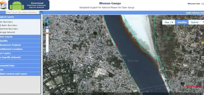
Pollution Monitoring of River Ganga Using Geospatial and Crowd-Sourcing Technologies
As reported by Business Standard, the Government of India’s flagship Clean Ganga Mission, National Mission for Clean Ganga (NMCG), Ministry of Water Resources, River Development and Ganga Rejuvenation and National
NRSC Announces Course on Hyperspectral Remote Sensing
National Remote Sensing Agency (NRSA) was established as a registered society on 2nd September 1974 by Department of Science & Technology, based on a Union Cabinet approval dated December 13,

NRSC Offering Special Course on Microwave Remote Sensing Applications
National Remote Sensing Agency (NRSA) was established as a registered society on 2nd September 1974 by Department of Science & Technology, based on a Union Cabinet approval dated December 13,

Tribal Ministry to Use Satellite Mapping to Develop Water Bodies
The Ministry of Tribal Affairs (MoTA) is planning to use satellite mapping to identify potential water collection spots, which could be developed for fish culture and other purposes in order
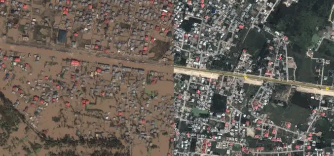
Kashmir Floods Monitored By Latest Satellite Technology
Union Minister Jitendra Singh said that Kashmir floods are being constantly monitored by latest satellite technology at the National Remote Sensing Centre. “Kashmir floods are being constantly monitored by latest

Earth Station on Brazilian Land to get Data from IRS
In recent news, Prime Minister’s Office has informed that India and Brazil on Wednesday signed an agreement in Brasilia on cooperation in augmentation of a Brazilian earth station for receiving and
