
Tag "NDVI"
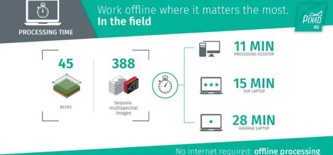
The Power of Offline Processing: Why Desktop is Essential for Drone Mapping in Agriculture
Part 2: Processing in the Field In Part 1 of this mini-series we went over why it makes sense in agriculture to import images directly to Pix4Dag Desktop. We concluded that
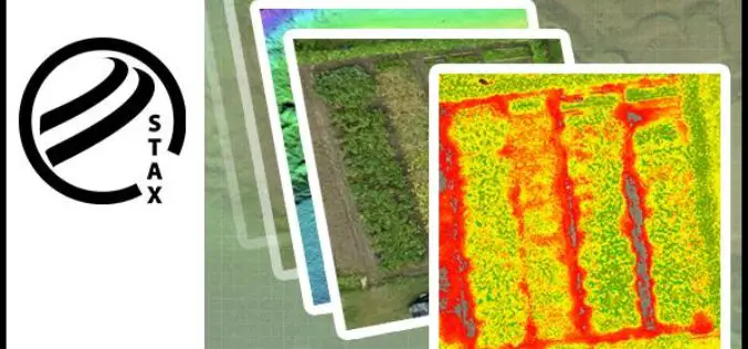
PCI Geomatics Releases STAX for UAV
MARKHAM, Ontario, Canada — March 07, 2017: PCI Geomatics, a world-leading developer of remote sensing and photogrammetric software and systems, announced today that it has released a new UAV image

In Defense of Desktop: Why Desktop is Essential for Drone Mapping in Agriculture
Part 1: How quickly can you go from landing to processing? If you want an NDVI map while you’re still in the field, cut out a potentially long upload to
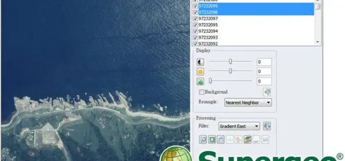
Experience Super Easy Raster Data Processing with a Single Click
Supergeo has added the Image Analyzer on the upcoming SuperGIS Desktop 10, which will provide greater convenience for GIS users to process raster data. Image Analyzer can integrate raster data

Hyperspectral Narrowband and Multispectral Broadband Indices for Remote Sensing of Crop Evapotranspiration and its Components
Hyperspectral narrowband and multispectral broadband indices for remote sensing of crop evapotranspiration and its components (transpiration and soil evaporation) By: Michael T. Marshall, Prasad S. Thenkabail, Trent Biggs, and Kirk Post
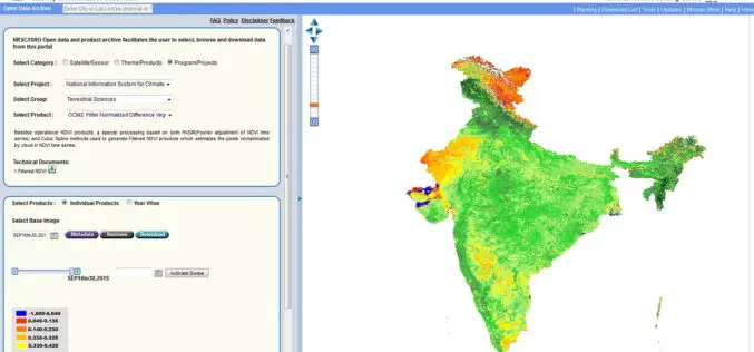
Bhuvan Updates | OGC Services, Active Agricultural Fire Locations, Snow Albedo, Filtered NDVI
Bhuvan, (lit: Earth), is a software application which allows users to explore a 2D/3D representation of the surface of the Earth. The browser is specifically tailored to view India, offering
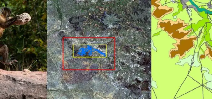
Remote Sensing Technology Is Used to Map Monkey with Hominid like Behavior
Biologists are fascinated by the applications of remote sensing and geographic information system (GIS) to the characterization of wildlife habitats as an area of growing significance for conservation. “Remote sensing
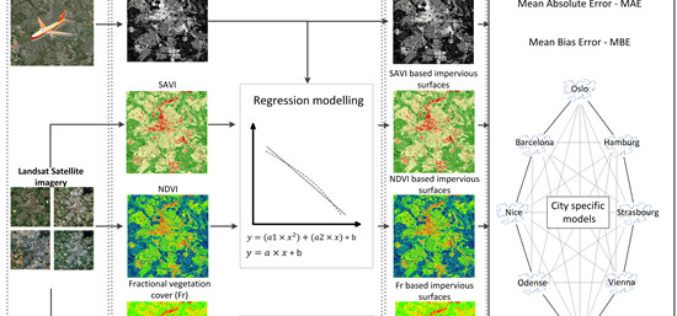
Using Landsat Vegetation Indices to Estimate Impervious Surface Fractions for European Cities
Using Landsat Vegetation Indices to Estimate Impervious Surface Fractions for European Cities – Kaspersen, P.S.; Fensholt, R.; Drews, M. Using Landsat Vegetation Indices to Estimate Impervious Surface Fractions for European Cities.
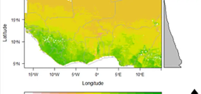
Space Technology Identifies Vulnerable Regions in West Africa
University of Leicester researchers in collaboration with NASA use satellites to map land degradation in Sub-Saharan West Africa A group of international researchers led by the Centre for Landscape and

Upcoming Changes to USGS ESPA Processing and Output options of Surface Reflectance Climate Data
Today I received an email from USGS as a notice of changes coming soon to the USGS EROS Science Processing Architecture (ESPA) interface (https://espa.cr.usgs.gov/) , that allows you to process Landsat 4/5 Thematic
