
Tag "NASA"
The Government of Canada Announces Investment in Innovative Mapping System for First-Ever Global Surface Water Survey
Government of Canada supports excellence in a key technological capability August 18, 2014 – Georgetown, Ontario: The Honourable Kevin Sorenson, Minister of State (Finance), and Member of Parliament Michael Chong (Wellington–Halton
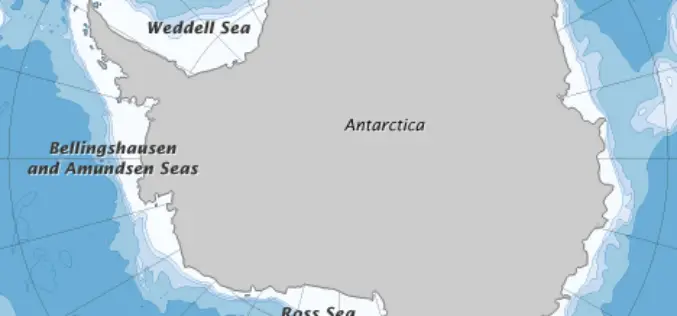
Error Discovered in Antarctic Sea-ice Record
Rising temperatures have caused the amount of Arctic sea ice to shrink dramatically since global observations began in the 1970s. But on the other side of the world, sea ice

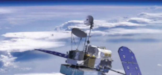
NASA-CNES Move Forward with Global Water and Ocean Surface Mission
NASA and the French space agency Centre National d’Études Spatiales (CNES) have agreed to jointly build, launch, and operate a spacecraft to conduct the first-ever global survey of Earth’s surface
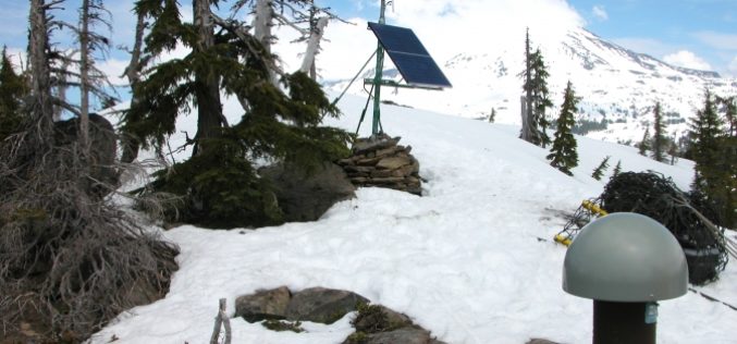
NASA Uses GPS to Find Sierra Water Weight
For the first time, NASA scientists have used GPS to find the total weight of winter snowpack and soil moisture in California’s Sierra Nevada. The new results complement other satellite

UNSW -NASA One Week Short Course on Radar Remote Sensing For Postgraduate Students
UNSW -NASA One Week Short Course on Radar Remote Sensing For Postgraduate Students UNSW and NASA/JPL will jointly offer a one-week intensive short-course, GMAT 9606 Radar Remote Sensing (6

NASA’s Double Pulse Laser- LiDAR to Study CO2
In recent news, a team of engineers at NASA Langley Research Center has developed world’s first double-pulsed laser system that make measurements of CO2 with highest degree of accuracy, all
Information Boucher on Global Precipitation Measurement (GPM) Core Observatory
The Global Precipitation Measurement (GPM) mission is an international partnership co-led by NASA and the Japan Aerospace Exploration Agency (JAXA). The mission centers on the deployment of the GPM Core
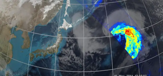
NASA | GPM’s Stormy New View
The GPM Core Observatory was the first of five planned Earth science launches for the agency in 2014. The joint NASA/JAXA mission will study rain and snow around the world,
First Images Available from NASA-JAXA Global Rain and Snowfall Satellite
NASA and the Japan Aerospace Exploration Agency (JAXA) have released the first images captured by their newest Earth-observing satellite, the Global Precipitation Measurement (GPM) Core Observatory, which launched into space

NOAA and NASA Launch Coastal Vulnerability Innovation Challenge
Coastal communities are becoming increasingly vulnerable to the risk of damage from coastal inundation. We only have to remember the recent impact of Hurricane Sandy on communities in the northeast
