
Tag "mosaicking"
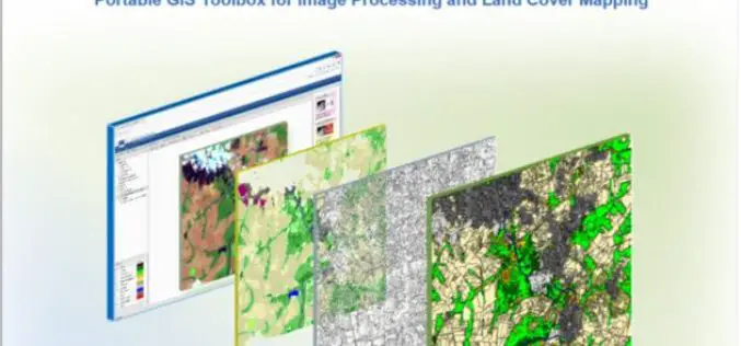
IMPACT: Open-source Software for Image Processing and Land Cover Mapping
The image processing and land cover mapping community can enjoy a new free software developed by the EU Joint Research Centre. The IMPACT tool is a portable browser-based application for

PCI Geomatics Webinar: Ortho-Mosaicking with Geomatica
Webinar: Ortho-Mosaicking with Geomatica PCI Geomatics is the developer of Geomatica- a complete and integrated desktop software that features tools for remote sensing, digital photogrammetry, geospatial analysis, map production, mosaicking
Master Geomatica from the comfort of your Home! 2015 Training Sessions on Now!
PCI Geomatics is the world leader in geo-imaging products and solutions. PCI Geomatics has set the standard in remote sensing and image processing tools offering customized solutions to the geomatics

PCI Geomatics Announces Release of Geomatica 2015
MARKHAM, Ontario, Canada—April 28, 2015: PCI Geomatics, a world leading developer of geo-imaging software and systems, today announces the release of Geomatica 2015; the latest version of the company’s complete
