
Tag "Minnesota"
GIS
High Resolution Tree Mapping for Minnesota
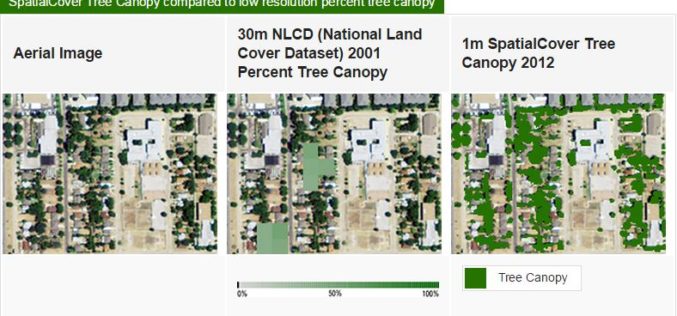
EarthDefine has created a high resolution tree mapping datasets for Minnesota’s tree in unprecedented detail. The high resolution seamless tree canopy dataset for Minnesota have 98% accuracy and 30 times
GIS
Minnesota Municipality Using GIS for Public Utilities Outage Management
In recent news by American City & County, Minnesota municipality is using GIS for efficient handling of public utility outages. A Minnesota based company “Rochester Public Utilities”, provides services to more than 47,000 power
