
Tag "Marine"

Satellite Data for Spatial Mapping of Marine Fisheries
Kochi, India – According to recent news reported by The Hindu, The Central Marine Fisheries Research Institute (CMFRI) will make use of remote sensing satellite data for the spatial mapping of
ADSIC Contracts Proteus FZC to Provide TCarta Marine Spatial Data Package for Arabian Gulf
Abu Dhabi, 20th July 2017 – Proteus FZC, Middle East’s leading provider of remote sensing services has been contracted by the Abu Dhabi Systems & Information Center (ADSIC) to provide 2m
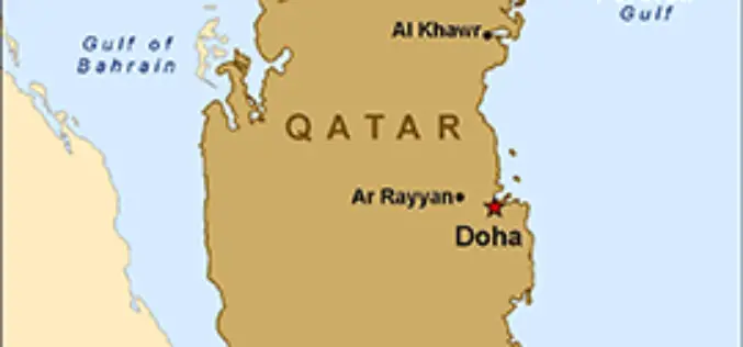
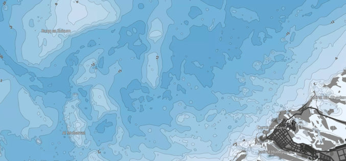
Qatar is Using GIS to Map and Analyse Fishing Reserves
In recent news, Qatar is developing a geographical information system (GIS) to map and analyse its marine resources, mainly fishing reserves. The fisheries department is busy assessing the country’s fish reserves

Mapping of Multi-Hazard Coastal Vulnerability
Earth System Science Organization (ESSO) – Indian National Centre for Ocean Information Services (INCOIS), Hyderabad and ESSO-Integrated Coastal and Marine Area Management (ICMAM), Chennai have carried out mapping and demarcating of
