
Tag "mapping"
Orbit GT Releases UAS Mapping v17.1 With Cloud Upload Feature at UAV EXPO, Brussels
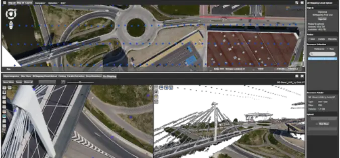
Orbit GT releases v17.1 of its UAS Mapping desktop product including the all-new Upload to the Cloud feature. It is available for download today from our website www.orbitgt.com. “This upgrade includes

Explore Places of Tourist Interest – Ajmer City
Contributed By:- Ajmer, located in the Ajmer District of Rajasthan is the 5th largest city of the state, and is located at a distance of 135 km from the capital
Orbit GT Releases Mobile Mapping Content Manager v17.1 With Cloud Upload Feature
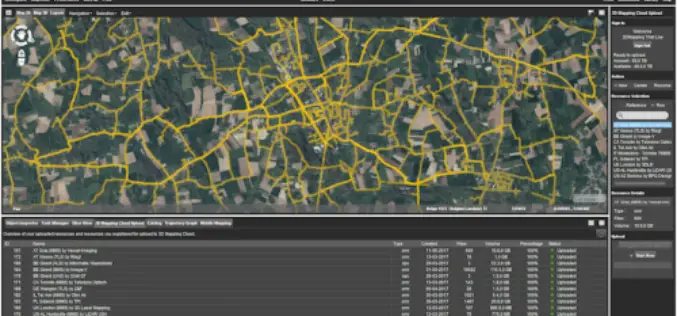
Orbit GT releases v17.1 of its industry-leading Mobile Mapping Content Manager product including the all-new Upload to the Cloud feature. It is available for download today from our website www.orbitgt.com.
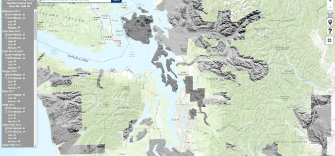
Washington State Department of Natural Resources Published New Landslide Mapping Standards Using LiDAR
Protocol standardizes methods for using LiDAR to map landslides in Washington State The Washington State Department of Natural Resources (DNR) has published standardized methods for mapping landslides in Washington using

Maharashtra Government to Spend INR 260 Crore for GIS Mapping of ULBs
According to recent news by TOI – The state cabinet on Tuesday sanctioned Rs 260 crore for GIS mapping(Geographic Information System) of all the C and D municipal corporations, Councils

Esri India Webinar: Mapping, Advanced Analytics and Sharing Maps with ArcGIS Desktop 10.5
Webinar: Mapping, Advanced Analytics and Sharing Maps with ArcGIS Desktop 10.5 Date: Thursday, May 25, 2017 | 11:00 AM IST onwards ArcGIS 10.5 is a big release; arguably one of

30 Years of Success Leads DAT/EM to Virtual Reality and UAS
30 Years of Success Leads DAT/EM to Virtual Reality and UAS Anchorage, Alaska, USA. May 10, 2017- In 1987, a group of photogrammetric professionals envisioned a product that would bridge the

PrecisionHawk Launches Free PrecisionMapper Software for Drone Mapping
Now drone operators can stitch an unlimited number of photos, create maps without resolution limits and run algorithms to analyze their data for free PrecisionHawk, a leading commercial drone and

Trimble Geospatial Webinar “Mobile Mapping for Indoor Spaces” Featuring TIMMS
Trimble Geospatial Webinar “Mobile Mapping for Indoor Spaces” Featuring TIMMS 08am MT/ 4pm MT | MAY 17, 2017 Take a ride through the entire workflow of Trimble’s Indoor Mobile Mapping

senseFly Corridor Solution Boosts Efficiency of Linear Mapping Projects
Today’s new combined hardware/software release makes assessing linear assets with UAS easier and less data-intensive than ever before senseFly, the world’s leading producer of mapping drones, today announces senseFly Corridor,
