
Tag "mapping"

Everything You Always Wanted to Know on “Digital Information in 3D”!
November 4 and 5, 2015, RIEGL attended and presented at 3D Laser Mapping’s User Conference “Digital Information in 3D” at the Prince Philip House in London. At the event, the
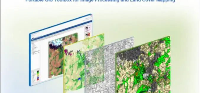
IMPACT: Open-source Software for Image Processing and Land Cover Mapping
The image processing and land cover mapping community can enjoy a new free software developed by the EU Joint Research Centre. The IMPACT tool is a portable browser-based application for
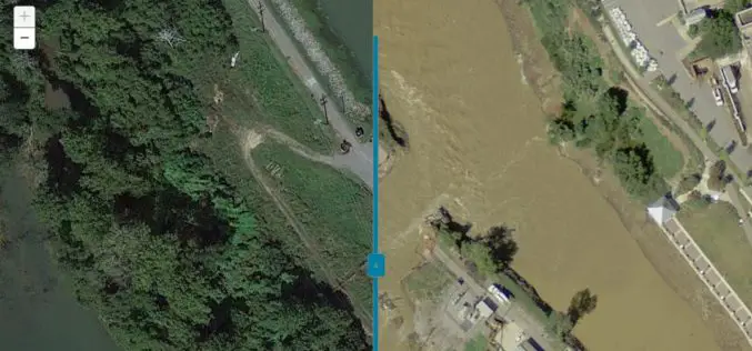
Imagery Assists Disaster Response in South Carolina
COLUMBIA, S.C. (Nov. 4, 2015) — One month ago today, a “thousand-year” rain event hit South Carolina, spurring widespread flooding throughout much of the state. In an effort to address the
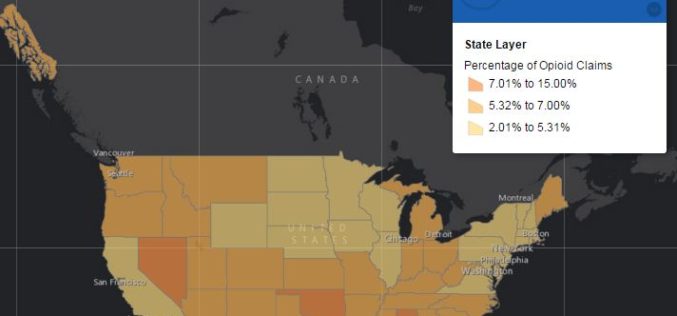
Centers for Medicare & Medicaid Services Has Launched Drug Mapping Tool Available
Interactive online drug mapping tool allows public to search Medicare Part D opioid prescription claims data at the state, county, and ZIP code levels. The Centers for Medicare & Medicaid

OS Maps Play a Role in the New UK Passports
The latest UK passport design was released yesterday and we’re extremely pleased to see a range of mapping from OS OpenData across the pages. Launched at Shakespeare’s Globe in London, the
Join Free Training on Bhuvan – Gateway to Geospatial World
Training on Bhuvan – Gateway to Geospatial World December 08 – 09, 2015 Bhuvan, (lit: Earth), is a software application which allows users to explore a 2D/3D representation of the

PhD Candidate Unmanned Aerial Vehicles (UAVs) for Cadastral Mapping
The University of Twente. We stand for life sciences and technology. High tech and human touch. Education and research that matter. New technology which drives change, innovation and progress in
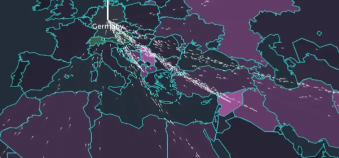
Mapping to Visualize the European Refugee Crisis
Europe is experiencing the biggest refugee crisis since World War II. The map shows the flow of asylum seekers to European countries over time. The data from the UN refugee agency (UNHCR) publishes monthly

OpenStreetMap for Emergency Response
This past week was intense – the most powerful hurricane ever recorded in the Western Hemisphere made landfall, just missing major population centers and avoiding catastrophic damage. Three days later,

A Drone with a Sense of Building Its Own Maps
MIT Technology Review – Researchers from the Swiss Federal Institute of Technology in Zurich are making drones more independent with a sense of building its own direction. They have demonstrated
