
Tag "mapping"

US Environmental Protection Agency Chooses SimActive’s Correlator3D
SimActive Inc., a world-leading developer of photogrammetry software, has been selected by the United States Environmental Protection Agency (USEPA). They are using Correlator3D™ to create 3D datasets of vegetation for
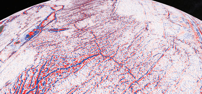
Satellite Maps Reveal Small Tectonic Plate in the Indian Ocean
A team of Australian and U.S. researchers has found a small tectonic plate or microplate in the Indian Ocean. Using Satellite maps, researchers discovered the Indian Ocean microplate, called Mammerickx Microplate and measuring
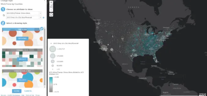
November Update of ArcGIS Online Features
Esri has released the November 2015 update for ArcGIS Online features, which includes new options for visualizing your data, enhancements to administering your organization, and improvements to the design of the
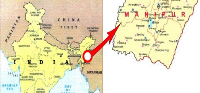
Manipur Has Launched ‘Make In Manipur’ and GIS Mapping for Sericulture Activities
Imphal – Manipur government has launched ‘Make in Manipur’ and GIS mapping for sericulture activities in the region. The move aimed to woo investors and generate employment in the state. Manipur
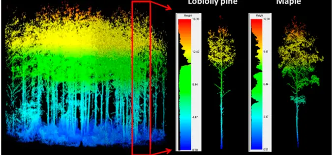
LiDAR Scanning Can Help Identify Structurally Heterogeneous Forest Areas
The inequality of tree sizes in a forest is an important factor affecting its structure and ecology. Forest management practices favouring natural regeneration can result in greater heterogeneity and complexity

GAIL to Use Drones, Satellite Mapping To Monitor Pipeline Network
GAIL (India) Ltd has decided to use drones and satellite imagery to map and monitor its pipeline network while expanding its Sahyogi (partner) scheme to detect/prevent encroachment and terror attack
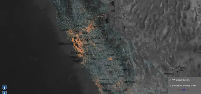
Mapping Tool to Map Impact of Non-compliant Volkswagen Cars
Based on the ICCT report, EPA has started an investigation into Volkswagen’s “clean diesel” vehicle fleet. It has been found that Volkswagen installed “defeat devices” to enable the cars to
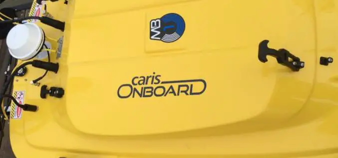
Official release of CARIS Onboard 1.0: A Real-time Data Processing and Mapping Application
CARIS is pleased to announce its release of the highly anticipated, near real-time data processing and mapping application, CARIS Onboard™. The development of this new technology will revolutionize the way
Geological Survey of India to Map Geological Potential Areas of the Country
Geological Survey of India (GSI) will soon take up the ambitious National Airborne Geophysical Mapping project covering 8 lakh sq kms including the Obvious Geological Potential (OGP) area, which includes
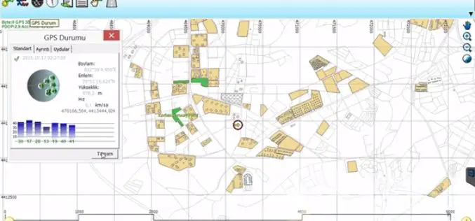
An Integrated Workflow for Cadastre Mapping
Disputing ownership of real estate often occurs in a country with long history. Before the modernization, people usually just roughly point out their properties by obvious and immovable landscapes, such
