
Tag "mapping"
Ahmedabad to go for Base map Mapping for Real-time Civic Services Monitoring
Gujrat, India – Ahmedabad Municipal Corporation (AMC) has approached ISRO’s Space Application Centre (SAC) for preparing a base map for Ahmedabad. The base map is a prerequisite for implementing the

Drone Mapping in Gurgaon to Create Administrative Tools
According to recent news by The Economic Times, drones was used to complete a minute drone aerial mapping exercise of Sohna town, Gurgaon (near NCR), to create new age administrative

Applied Geodesy & Geographic Calculator Public Training
Applied Geodesy & Geographic Calculator Public Training This one day session covers the foundations and principles of Geodesy and mapping. Whether you’re an expert in GIS or just starting out,
UN Expert Committee Outline the Future Trends in Digital Mapping
A new report setting out the five to ten-year vision of the rapidly growing geospatial information industry has been published by the United Nations Committee of Experts on Global Geospatial
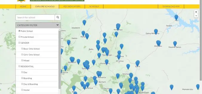
Ghana: Education Ministry Launches School Mapping Portal
The School Mapping and Monitoring system, a programme under the Secondary Education Improvement Project (SEIP), has been launched under the host name www.ghanaschoolsinfo.org. Speaking at the launch, the Minister for
Contour Mapping for Flood Free Mumbai
According to recent news by the Hindustan Times, Maharastra Chief Minister Devendra Fadnavis has informed in State Assembly that contour mapping will be made mandatory for builders who seek permission
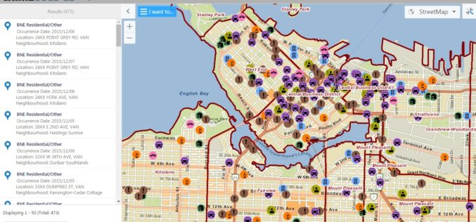
Vancouver Police Department Launch Crime Mapping Tool
The Vancouver Police Department (VPD) has launched a public version of an interactive crime mapping tool called GeoDASH, which officers have been using for about a year now. GeoDASH stands for
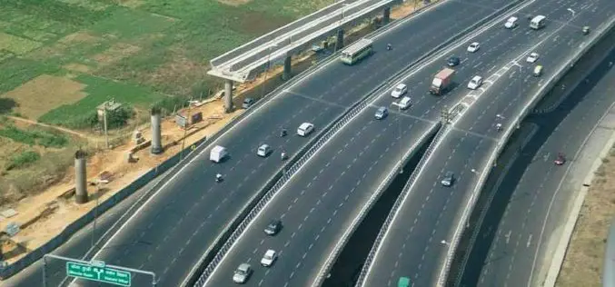
NHAI to Use Satellites for Road Mapping
According to recent news, the Central Road Research Institute (CRRI) has developed several technologies/procedures/methods for construction and maintenance of Indian roads such as cold mix & warm mix technologies for

Webinar on Remote Sensing Methods to Inform Adaptive Management of Phragmites
Remote Sensing Pt II: Implementing practical field & remote sensing methods to inform adaptive management of Phragmites Fri, Dec 11, 2015 12:30 AM – 1:30 AM IST Show in My

Manchester Wins £10m Prize to Become World Leader in ‘Smart City’ Technology
Ordnance Survey is part of a public – private consortium that is celebrating winning a £10m competition for Manchester to be the UK’s Internet of Things (IoT) Demonstrator, awarded by the
