
Tag "mapping"

Combining SAR and Optical Imagery for Mapping and Change Detection
PCI Geomatica Webinar: Combining SAR and Optical Imagery for Mapping and Change Detection February 25, 2016 | 4:00 AM EST – 9:00 AM (GMT) | 2:00 PM EST – 7:00 PM (GMT) PCI
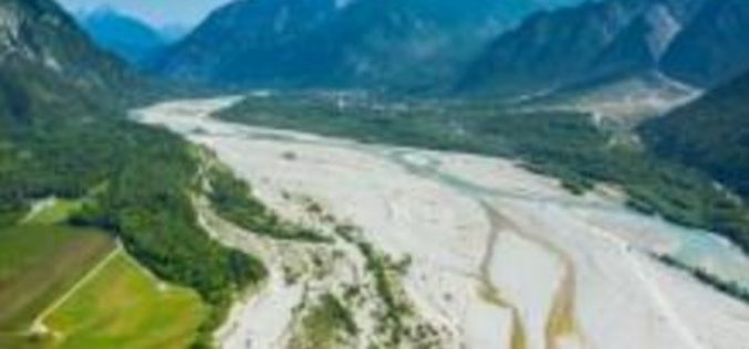
A New Method for Mapping River Properties Using Remote Sensing
A JRC-led article published in Remote Sensing last week presents a new method for mapping river properties using remote sensing. The new method provides a tool for monitoring and characterising the
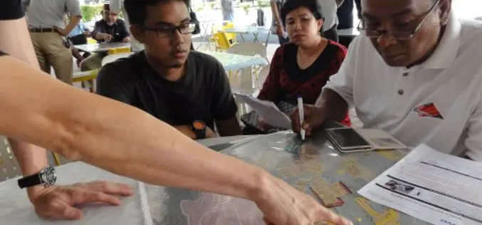
Community Mapping to Educate on Landslides
Kuala Lumpur – A local community-based organisation on landslides and slope safety, SlopeWatch embarked on a journey to educate hillside citizens on signs of slope failures to better equip them in

Ordnance Survey to Map Oman’s World Class Geospatial Path
Ordnance Survey (OS) has signed a deal with the Sultanate of Oman Ministry of Defence to help the National Survey Authority (NSA) advance its position as Oman’s national mapping authority. This
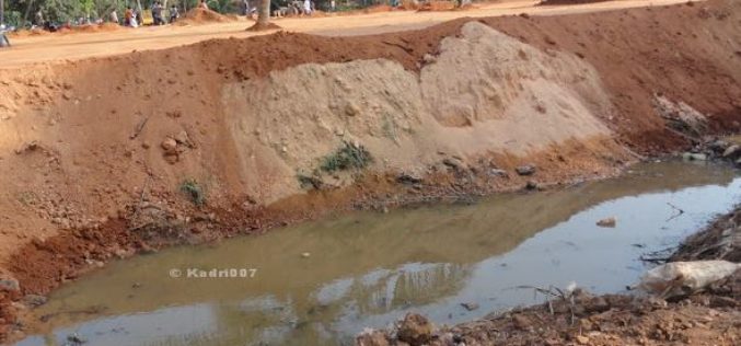
Saving India’s Vanishing Water Bodies
“GIS technology plays an important role in managing our natural and man-made water infrastructure, and is readily available”,The recent floods in Chennai have been largely blamed on water body encroachments.
Orbit rolls out GIS Mapping System for Housing Management
Orbit, which manages homes across the Midlands, East and South East, has rolled out a web-based GIS system for its 1,300 staff to access geographic information, maps and analysis to

Blue Marble Webinar: Working with Vector Data in Global Mapper
In mapping technology, vector data takes the form of points, lines, or polygons, with each variant distinguished by the geometric relationship of a series of x and y (and sometimes
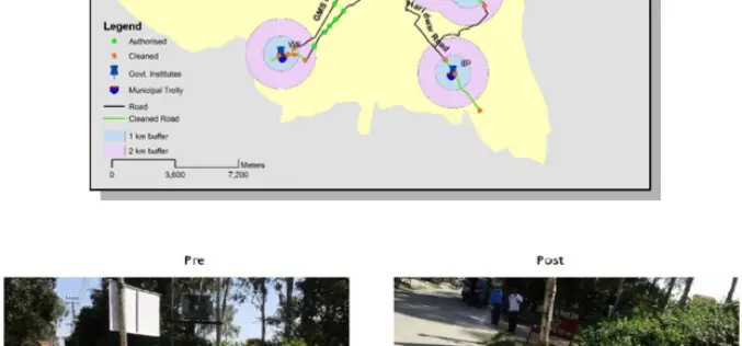
ISRO Utilizes Geospatial Technology for Swachh Bharat Abhiyaan
A novel initiative to contribute in the Swachh Bharat Abhiyaan using the Geospatial Technology (GST) was taken up jointly by the central Government institutions in Dehradun. This initiative was supported
World Bank Has Chosen UAV for Innovative Local Mapping
The World Bank is implementing a $12 million Real Estate and Cadastre Project to assist the government in producing a national cadastre system and geospatial data infrastructure. The team has

City of Hudson Goes for GIS mapping of Utilities
According to recent news, City of Hudson will spend an estimated $222,000 to create the digital mapping for its storm sewer, sanitary sewer and water utilities. The City Council on
