
Tag "mapping"
Chinese Internet Giant Baidu to Expand Mapping Services Abroad
According to recent news by the Shanghai Daily, Chinese Internet giant Baidu has recently announced that it will expand its mapping service to over 150 countries and regions by the

Commercial UAV Expo 2016 at Las Vegas
Commercial UAV Expo is North America’s leading trade show and conference for the commercial drone market, focusing on: Surveying & Mapping Civil Infrastructure Process, Power & Utilities Aggregates & Mining Construction Law
Orbit GT Launches New UAS Mapping Software at SPAR
April 11, 2016 – Orbit GT will be launching new UAS Mapping software at the upcoming SPAR event in Houston, USA. “We’re very pleased to announce that our UAS Mapping
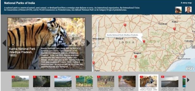
Story Maps by Esri Inc
Contributed By – What Kind of Story Do You Want to Tell? A. Sequential, Place-based Narratives 1. Story Map Tour℠ This app presents a sequential, place-based
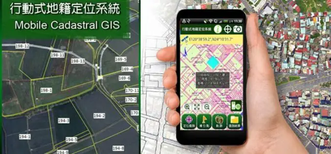
Smart Mobile Solution for Cadastral Mapping, Time to Go International!
It’s time to announce the next huge leap of SuperGIS Mobile Solution! The well-known Mobile Cadastral App powered by Supergeo, one of the best-selling land management and cadastral survey work
Satellite Mapping for Property Tax Recovery
According to recent news by ToI, Navi Mumbai Municipal Corporation (NMMC) property department may levy property taxes which will also account for the alterations done from this year. The department
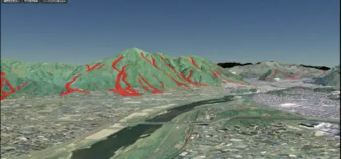
Geospatial Information Authority of Japan Released a Free Online 3D Mapping Service
A national surveying institute has released a free online 3D mapping service that could help increase natural disaster preparedness by showing accurate renditions and contours of landforms. Created by the
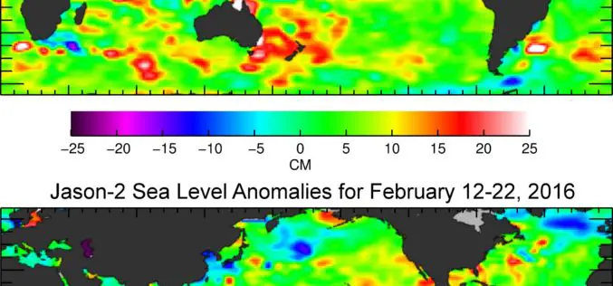
Jason-3 Begins Mapping Oceans
Just over a month after launch, Jason-3, a U.S.-European oceanography satellite mission with NASA participation, has produced its first complete science map of global sea surface height, capturing the current
GIS-enabled Complete List of Indian Fauna Soon: Zoological Survey of India
A simple click of a button will soon tell you which animals live where in India, courtesy a GIS-enabled web-based platform where information on over 96,000 species will be provided
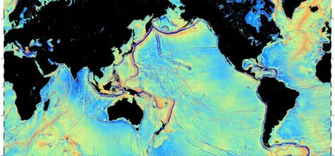
Mapping the Seafloor with Geodesy
Advanced sonar technology has allowed ships to create highly detailed topographic maps, it would take 125-200 ship-years to survey the deep oceans alone, costing billions of dollars. Gravity models are
