
Tag "mapping"
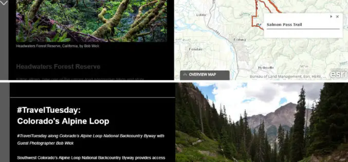
The Bureau of Land Management Uses Esri Story Maps to Encourage Public Land Exploration
Engaging the Public through the Travelogues of Wilderness Specialist Bob Wick Redlands, California—The Bureau of Land Management (BLM) now uses Esri Story Maps to encourage exploration of the United States’
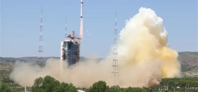
China Launches New High-resolution Satellite for Civilian Mapping
IANS – China on Monday launched a new civilian high-resolution mapping satellite from the Taiyuan Satellite Launch Centre in Shanxi province. The 2.7-tonne Ziyuan III 02 satellite soared on the back
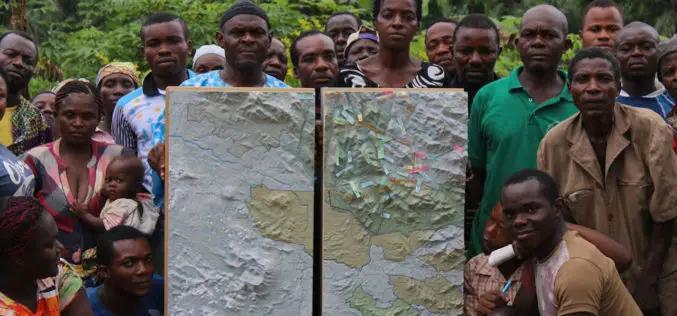
Cameroon’s First Participatory 3D Mapping for Forest Monitoring and Conservation Management
A three-dimensional model of part of the Cameroon Highlands will be unveiled on Monday 30 May in an official ceremony at the Southwest Regional Delegation of Forestry and Wildlife (MINFOF).
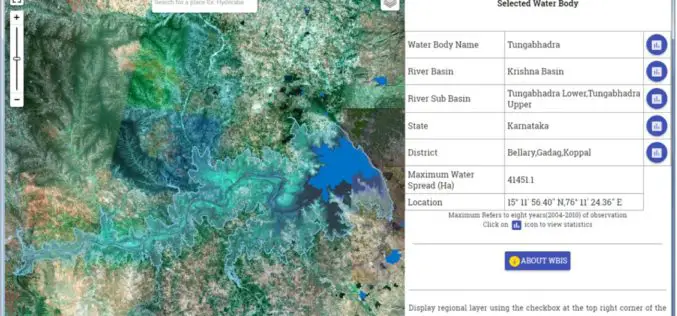
Temporal Repetitive Mapping of Water Bodies Across India
National Remote Sensing Centre (NRSC), ISRO at Hyderabad monitors the status of all the water bodies in the country using satellite images and provides water spread area information on a
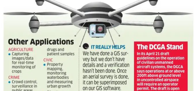
Bengaluru Civic Corporation to Use Drones for Mapping Property & Taxes
India-According to recent news, Bengaluru civic corporation is all set to use unmanned aerial systems (UAS), commonly known as drones, to map urban properties and property taxes. This could help the

India: “The Geospatial Information Regulation Bill, 2016”
The Ministry of Home Affairs, Government of India has requested for comments/suggestions on draft “The Geospatial Information Regulation Bill, 2016”. “To regulate the acquisition, dissemination, publication and distribution of geospatial information
NMDC Inks MoU with ISRO for Mineral Mapping
In a bid to make use of satellite-based geological mapping capability for mineral exploration, National Mineral Development Corporation (NMDC) has signed a memorandum of understanding (MoU) with Indian Space Research

A New Mobile Phone App for Grassroots Mapping
University of Exeter academics have created an app which could help aid humanitarian rescue work in disaster-struck regions by using geographic data to map landscapes. The android mobile phone application
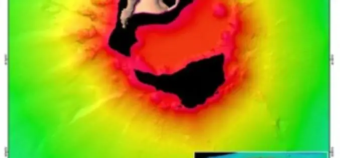
Scientists Explore Earth’s Newest Land Using Advanced, High-Resolution 3D Mapping
SUVA, FIJI – Research vessel (R/V) Falkor will return to port today after 28 days at sea conducting pioneering studies including mapping the Earth’s newest island landscape in the Kingdom
The Power of Maps
The map is a powerful way to visualize data and tell stories. As the internet becomes more and more popular, it is a lot easier to share your maps than

