
Tag "mapping software"

Supergeo Expand Partnership with Géo.RM, France
Supergeo Technologies, the global leading GIS software and solution provider, announced the renewal of SuperGIS software contract with Géo. RM, France. The extended collaboration will continue bringing French-speaking users the

Supergeo Renews Partnership with Star Vision for GIS Development in Southeast China
Supergeo Technologies, the global leading GIS software and solution provider, announced the extended partnership with Star Vision, the professional GIS consulting and surveying firm in Hong Kong, to further develop

High Accuracy and Advanced Field Work with Latest SuperSurv
To meet the great needs of high accuracy field data collection and better workflow via modern GNSS technology, Supergeo, the leading GIS software and solution provider, announces the latest SuperSurv
Powerful GIS Web Manager in SuperGIS Server 3.2
Supergeo, the leading GIS software and solution provider, released the newest version of SuperGIS Server 3.2 to help enterprises share diverse geospatial data effortlessly. The latest SuperGIS Server 3.2 is

Polytechnic University of Marche, Italy, Select SuperGIS for Geospatial Applications
The Polytechnic University of Marche, Italy (aka, UNIVPM) selects SuperGIS Desktop to build a professional teaching laboratory of engineering, environment observation and agriculture, to train outstanding geographic information personnel. Ranking
Discover Top 10 GIS Features with Latest SuperGIS Desktop
To make GIS software friendlier and easier to access, Supergeo, the leading GIS software provider, collects GIS users’ ideas around the world, and votes the 10 most useful features of
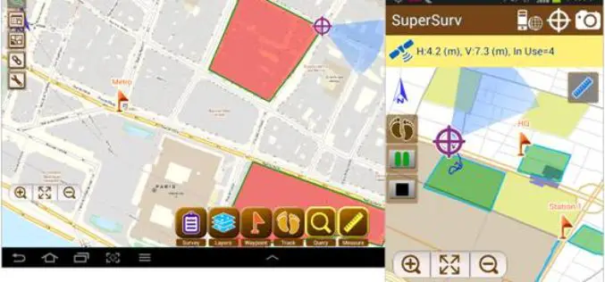
SuperSurv 3.2 Release Advanced GPS Support and Data Collection Functions
Developed by Supergeo, the latest version of SuperSurv (Android) 3.2 is upgraded with stronger data collecting function by GPS and more precise and easy-to-use GPS manipulation interface, bringing
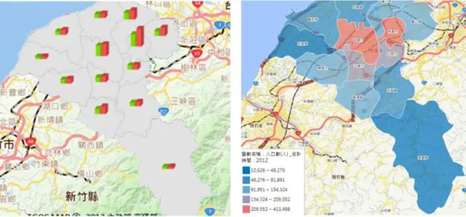
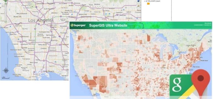
Statistics Map APIs Service Platform
Displaying statistical data on map extends GIS applications to more domains, as it is much easier and more informative for researchers to comprehend meanings of the data through its intuitive

Latest SuperGIS Desktop 3.2 Supports Lidar Data and New Analysis Functions
Supergeo Technologies, the leading global provider of complete GIS software and solutions, releases updated SuperGIS Desktop 3.2, which supports Lidar data and adds more analysis tools. SuperGIS Desktop 3.2 integrates

Supergeo Announces Partnership with T&B Radio Tech in Korea
Supergeo Technologies, the leading global provider of complete GIS software and solutions, authorized T&B Radio Tech, Republic of Korea, as a certified reseller to promote SuperGIS in information communication technology
