
Tag "LiDAR"
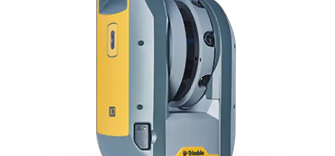
Trimble Blends Performance and Simplicity with New X7 3D Laser Scanning System
Innovative High-Speed 3D Laser Scanning System Simplifies Use, Increases Efficiency and Provides Confidence in the Field to Capture Digital Data SUNNYVALE, Calif., Sept. 16, 2019—Trimble (NASDAQ: TRMB) introduced today the Trimble®
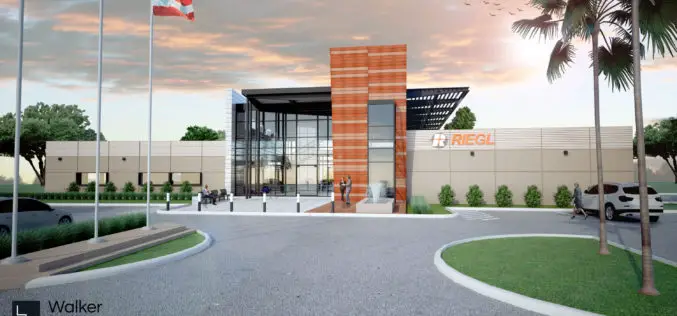
RIEGL Continues on Course for Success: RIEGL Invests in New Office and Production Facilities!
New, additional facility expansions at the headquarters in Austria as well as a new facility in the United States. RIEGL, an internationally successful manufacturer of LiDAR scanners for surveying applications

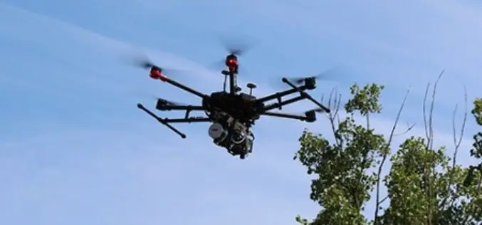
RME Geomatics Delivers Innovative Drone Technology for Government-Funded Build in Canada Innovation Program (BCIP)
Carp, Ontario– RME Geomatics, a world leading aerial survey services and technology company, announced today they have delivered a Renegade-M aircraft under the Canadian Federal Government Build in Canada Innovation

Echolocation And Its Technological Developments
Authored By: Introduction Dolphins utilize echolocation to discover things in their surroundings. The clicking-noises they utter bounce off things under the water & goes back to this smart mammal.
Bluesky uses Leica CityMapper to capture major UK cities in 3D
Heerbrugg, Switzerland, 21 November 2018 – Leica Geosystems, part of Hexagon, announced today the Leica CityMapper, the world’s first hybrid airborne sensor combining vertical and oblique aerial imagery together with
Golden Software Enhances 3D Data Visualization in Surfer 16
GOLDEN, Colorado, 13 November 2018 – Golden Software, a developer of affordable scientific graphics software, has enhanced the visualization capabilities in version 16 of its Surfer® gridding, contouring and 3D

3D Laser Mapping & GeoSLAM Global Merger Announcement
3D Laser Mapping Ltd and GeoSLAM Ltd Merge, Creating a Global Market Leader in Mapping and Monitoring Nottingham, England, 1st August 2018 – Leading UK laser scanning and monitoring companies’ 3D

A City in 2 Billion Points
July 31, 2018 – In 2014 the Institut Cartogràfic i Geològic de Catalunya (ICGC) scanned an area of 1900×1200 meters around the La Sagrada Família in the city of Barcelona using
Headwall Integrates Hyperspectral and LiDAR Aboard UAV Platforms
Enabling Remote Sensing Capabilities From Civil Infrastructure Inspection to Crop Monitoring BOLTON, MA, JUNE 11 – Headwall has introduced advanced sensor payloads consisting of hyperspectral sensors and LIDAR for deployment
NAKANIHON and RIEGL to Give Joint Presentation on Helicopter-based Airborne Bathymetric LiDAR Systems
19th JABLTCX workshop, June 26-28, 2018 Providence, Rhode Island, USA: NAKANIHON and RIEGL to Give Joint Presentation on Helicopter-based Airborne Bathymetric LiDAR Systems Horn, June 7, 2018 – After successfully integrating and mobilizing a
