
Tag "LANDFIRE"
E-books
GIS
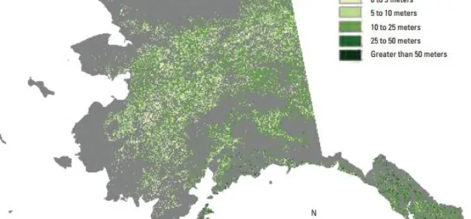
Enhanced Canopy Fuel Mapping by Integrating LiDAR Data
Background The Wildfire Sciences Team at the U.S. Geological Survey’s Earth Resources Observation and Science Center produces vegetation type, vegetation structure, and fuel products for the United States, primarily through
