
Tag "Kerala"
GIS
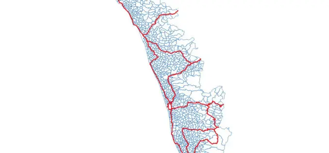
OSM Kerala Community Releases Local Body Boundary Map of Kerala
Recently OSM Kerala Community has released a free Local Body boundary map of Kerala. The data have map boundaries added for Corporations, Municipalities, and Gram Panchayat. As part of Kerala
GIS
Space-based Services Should be Used: Kerala Tourism Minister
Thiruvananthapuram, May 19 (PTI) Applications of space-based services should be used by government agencies and departments for betterment of administration and society, Kerala Tourism and Devaswom Minister Kadakampally Surendran said
GIS
Sustainable Land Utilization Modeling Using GIS and Remote Sensing
According to recent news published by The Hindu, The Kerala State Land Use Board (KSLUB) is gearing up to prepare a comprehensive data bank of resources coming under the Thiruvananthapuram
