
Tag "GNSS"
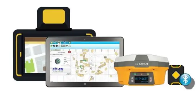
Collect Field Data with High Accuracy – Supergeo X Hi-Target
Supergeo provides GIS software on multiple platforms, including server, desktop, and mobile. Due to the rapid development of the mobile and smart devices in recent years, Supergeo has been dedicated
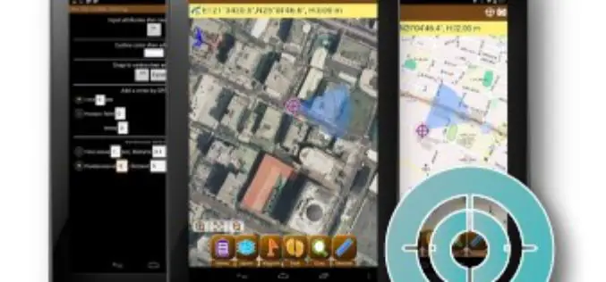
Conducting a More Precise Fieldwork
Receiving high accuracy data is the ultimate goal of fieldworkers and surveyors. Now, two core products of SuperGIS Mobile Series: SuperSurv for Android and SuperPad are all capable of receiving

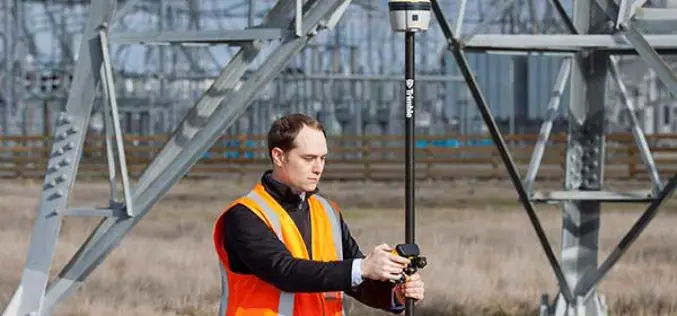
Trimble Acquires AXIO-NET GmbH – Recognized Provider of GNSS Services
Trimble Reinforces its Presence in Europe as a Leader in GNSS Correction Services SUNNYVALE, Calif., Aug. 1, 2016—Trimble (NASDAQ: TRMB) announced today the acquisition of AXIO-NET GmbH from Airbus Defence

Topcon Introduces Elite Survey Suite
Speed, ease-of-use and integration key to design LIVERMORE, Calif., USA/ CAPELLE A/D IJSSEL, The Netherlands – June 30, 2016 –Topcon Positioning Group announces a new suite featuring four integrated solutions
Trimble R2 GNSS Receiver Now Available for Data Collection
Collecting Professional Data Made Easier With Trimble R2 GNSS Receiver June 29, 2016 – Redlands, California—Esri announced today the availability of the Trimble R2 Global Navigation Satellite System (GNSS) receiver for

Trimble TDC100 Handheld GNSS Data Collector Combines Smartphone-Like User Experience with Professional-Grade Capabilities
Ruggedized and Highly Accurate Data Collection for GIS Professionals SAN DIEGO, Calif., June 28, 2016—Trimble (NASDAQ: TRMB) introduced today its Trimble® TDC100 handheld data collector. An entry-level Global Navigation Satellite

India-Nepal Border Pillars to be GPS-enabled
KATHMANDU: More than 8,000 pillars along the India-Nepal border will be linked to a Global Navigation Satellite System, allowing authorities for the first time to effectively manage the over 1,700-km-long
INTERGEO 2016 – Conference Programme Online
Karlsruhe, 16June 2016|“The topics being covered are as diverse as the geo community itself,” says Professor Karl-Friedrich Thöne, President of the DVW, describing the INTERGEO conference programme, which has just
Galileo and EGNOS Benefitting the Geospatial World
Speaking at this week’s Geospatial World Forum in Rotterdam, the European GNSS Agency (GSA) discussed the many benefits that EGNOS and Galileo offer the geospatial sector and, specifically, the surveying

Leica Captivate Experience Continues with Self-learning GNSS, Dynamic Lock for MultiStations
Leica Geosystems, industry leader of measurement technology, has announced the Leica Viva GS16 and updated Leica Captivate and SmartWorx Viva software. The GS16 is a truly self-learning GNSS receiver, able
