
Tag "GIS"

Boundless Launches Massively Scalable Geospatial Server for the Enterprise
Boundless Server Enterprise Serves Location Data In The Cloud; Offers Most Powerful Solution for Availability and Responsiveness St. Louis, MO – Jan. 30, 2018 – Boundless, the leader in open GIS,
GeoCalc SDK 7.4 Update Includes Support for New Projections and JSON Wrapper Classes for Calling to GeoCalc Cloud
Hallowell, Maine – January 23, 2018 – Blue Marble Geographics (bluemarblegeo.com) is pleased to announce the immediate availability of version 7.4 of the GeoCalc Software Development Kit (SDK). This powerful toolkit
Esri Releases World’s First Complete Utility GIS Platform
New Utility Network Management Extension Combines Advanced System of Record with Location-Based Analytics Redlands, California – January 22, 2018 – Esri, the global leader in geographic information system (GIS) technology and spatial analytics,

thinkWhere Takes a Global View with theMapCloud Platform
Stirling, Scotland, January 17, 2018 – Scottish Geographic Information Systems (GIS) company thinkWhere is setting its sights on global expansion with the launch of a new cloud-based platform for GIS and
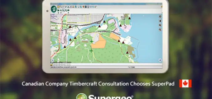
Canadian Company Timbercraft Consultation Chooses SuperPad
The global GIS software provider, Supergeo Technologies Inc., is excited to announce that the Canadian consulting firm Timbercraft Consultation Inc. selects SuperPad to record spatial data. Specialized in geographic data
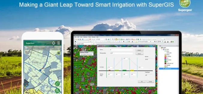
Making a Giant Leap Toward Smart Irrigation with SuperGIS
Geographic Information System (GIS) is becoming extremely popular nowadays for its capability of solving problems in the domains like cadastre management, network analysis, location selection, spatial statistics, etc. to name
Blue Marble Geographics Adds Chinese Reseller to its Worldwide Network of Partners
Hallowell, Maine – December 19, 2017 – Blue Marble Geographics (bluemarblegeo.com) is pleased to announce that Beijing E-Carto Technologies Co., Ltd. has joined the growing list of partner companies reselling and

Qatar to Develop 4D Mapping Technology to Boost Urban Planning and Other Applications
According to recent news by The Peninsula, the Center for Geographic Information Systems(CGIS) under the Ministry of Municipality and Environment is working on a cutting-edge technology to develop 4D mapping features
Esri Signs Global Enterprise Agreement with Airbus Defence and Space
New Agreement Gives Airbus Defence and Space Online Spatial Analytics for Faster, More Cost-Effective Operations November 30, 2017 – Redlands, California—Esri, the global leader in spatial analytics, today announced that it

Top 5 GIS Trends for 2018
Contributed By: You’re reading this because seamlessly integrating Geographical Information Systems (GIS) into your company’s IT infrastructure including SAP is crucial. Challenges you’re grappling with probably include absorbing tech upgrades
