
Tag "GIS"
Underground Utilities and Traffic Applications in 3D
SuperGIS 3D Earth Server is now focusing on the development of underground utilities and traffic applications. The product not only provides the ability to visualize and manage underground utilities in

Esri’s ArcGIS Online Approved as a Grade 5-12 Learning Resource in British Columbia
Cloud-based mapping platform provides opportunities to develop students’ spatial & critical thinking If you’re an educator in British Columbia looking for a way to engage your students in various subjects

Join Webinar: A Better World with Open Data – GIS Application
A Better World with Open Data – GIS Application Thursday, Oct 29, 2015 1:30 PM – 2:30 PM IST (Show in My Time Zone) Open data is, in fact, not

Using Geographic Information Systems (GIS) in Disease Control Programmes
The course ‘Using GIS in disease control programmes’ jointly organized by KIT and the International Institute for Geo-Information Science and Earth Observation (ITC) Enschede, combines expertise in geographic information systems

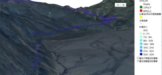
3D Maps of Buildings to Improve Disaster Management Plans
India – In order to improve disaster management plans, the Gurgaon administration has decided to prepare 3D maps of 100 buildings in the city, including office complexes and hospitals. Gurgaon
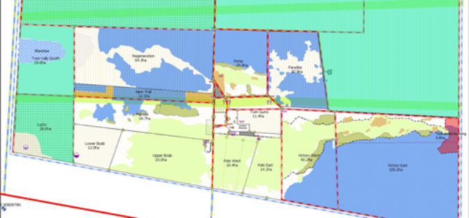
Sustainable Pasture Management – A Solution in West Australia
Scenario Overgrazing by sheep and cattle may lead to serious land degraded problems. In some sensitive ecosystems, like tropical savannahs or steppes, overgrazing would often cause irreversible desertification. Located in

Manipur Government Using GIS to Boost Handloom Industry
Manipur Commerce and Industries minister Govindas Konthoujam has distributed Rs 2.6 lakh each to 11 handloom clusters of Bishnupur district. The amount is distributed as the first instalment of the
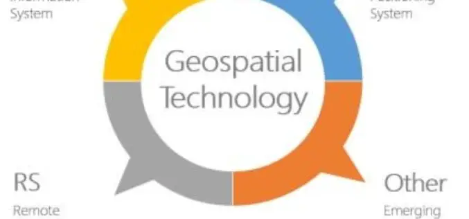
Geospatial Technologies Picking Up Greater Momentum
With the advancement in Remote Sensing and development in Geographic Information System and Global Positioning System, the applications of Geospatial Technologies in various fields have picked up greater momentum, a
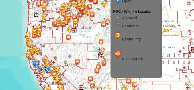
Interactive Tool to Access and Track Live, Wildfire Information
Free, Public Tool Consolidates Information to Provide Up-to-Date Disaster Snapshot WASHINGTON, D.C., Thursday, Sept. 17, 2015 — The American Red Cross has launched an interactive online map that consolidates multiple
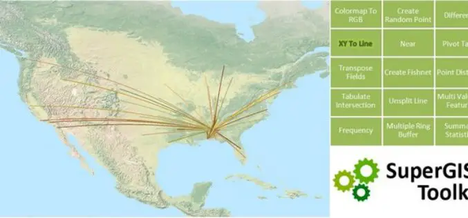
SuperGIS Toolkit 10, Driving Your GIS Tasks Powerfully!
With the popularity of spatial information and the improvements of data-collecting instruments, requirements for spatial data processing functions,across fields, are gradually increasing. In view of this, SuperGIS Desktop 10, which
