
Tag "GIS software"
Boundless Exchange 1.0 is Now Available!
Your Open Portal for Spatial Collaboration Boundless Exchange 1.0, a GIS content management platform powered by open source technology, is now available. Boundless Exchange enables spatial and mapping capabilities via
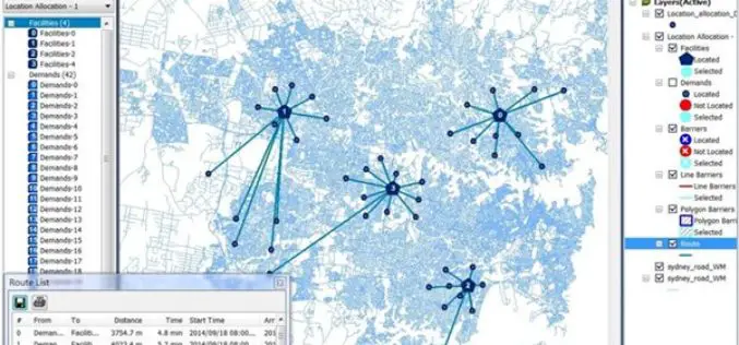
A Major Upgrade of SuperGIS Network Analyst
SuperGIS Network Analyst is one of the six extensions of SuperGIS Desktop, which is a powerful tool that enables users to conduct network analysis for finding the best route or

GIS Technology Proves Fundamental in Battle against Zika Virus
An Interactive Map Was Created by ASPR to Track the Zika Virus within the United States Redlands, California—Florida is home to more than 3.6 million women aged 15 to 44
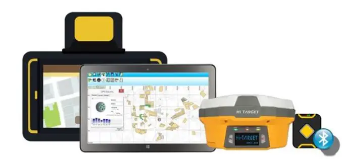
Collect Field Data with High Accuracy – Supergeo X Hi-Target
Supergeo provides GIS software on multiple platforms, including server, desktop, and mobile. Due to the rapid development of the mobile and smart devices in recent years, Supergeo has been dedicated

Conducting a More Precise Fieldwork
Receiving high accuracy data is the ultimate goal of fieldworkers and surveyors. Now, two core products of SuperGIS Mobile Series: SuperSurv for Android and SuperPad are all capable of receiving

Esri Announces Workforce for ArcGIS
Esri has announced the release of Workforce for ArcGIS. Workforce for ArcGIS enables a common view in the field and the office. Get the right worker to the right place with the
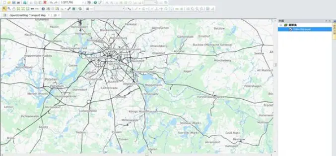
Online Map Tool Helps You to Design a Better Map
Many cartographers are often anxious about creating a map that is not attractive enough. In the latest updated version of SuperGIS Desktop 3.3 and 10, Supergeo will support users to

Esri India Webinar: Explore the World of Esri Mobile Apps and App Builders
Explore the World of Esri Mobile Apps and App Builders 27th July 2016, 11:00 AM IST onwards The webinar covers the ArcGIS apps and app builder capabilities. With a suite

PDF3D V2.13 Release Targets Engineering and Manufacturing Workflows in 3D
3D PDF conversion software leaders, PDF3D, today announce V2.13, a major update for their entire suite of products including PDF3D SDK, XML Server, ReportGen and PV+. ReportGen users can expect
Geographic Calculator 2016 Now Supports Petrel Database Files
Blue Marble Geographics is pleased to announce the immediate availability of Geographic Calculator 2016 Service Pack 1 (SP1). This intermediate release includes array of functional upgrades, usability improvements, and new

