
Tag "GIS software"

SuperGIS Manuals Are Now Available Online!
No matter you are a GIS beginner or an old hand; we always have some moments that are uncertain about how to use a particular function, like how to create

Global Mapper Mobile Now Available for Android Devices
Blue Marble Geographics is pleased to announce the immediate availability of a beta release of the Android version of its Global Mapper Mobile app. Mirroring the capabilities of the iOS
Global Mapper and Geographic Calculator Free Academic License Program is Now Live
Hallowell, Maine – May 2, 2017 – Blue Marble Geographics (www.bluemarblegeo.com) is pleased to announce the launch of its new academic licensing program with a new web page now available
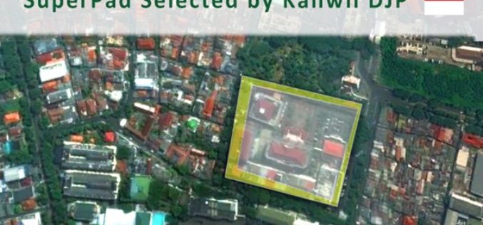
Taxation Authority in Indonesia Selects SuperPad 3.3 to Collect Data
With the assistance of Supergeo’s partner in Indonesia, DataScrip, the regional offices of Indonesian taxation authority recently selected SuperPad 3.3 as the mobile GIS software for spatial data collection. Under

SuperSurv Selected by Agricultural Company Socfinco
The global GIS software provider Supergeo Technologies Inc. is delighted to announce that its cutting-edge mobile GIS software SuperSurv has been chosen by Socfinco, the agricultural company. Located in Brussels,

TerraGo Edge 4.0 Re-Imagines the User Experience, Adds New Mobile Features and Expands ESRI® ArcGIS® Integration Options
Using a customer-driven, agile feedback loop, TerraGo Edge undergoes a complete redesign, improves every aspect of the user experience to help get work done faster, easier and more efficiently than
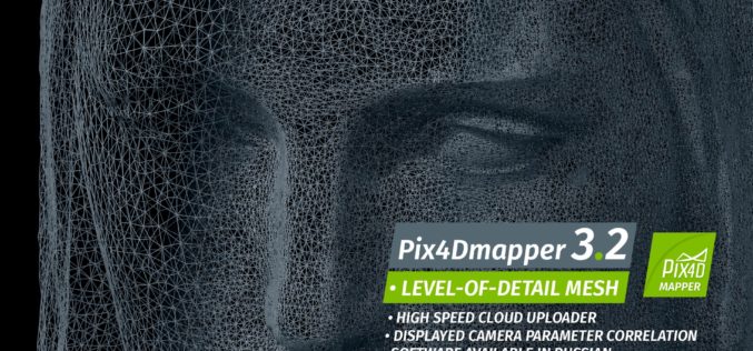
Pix4Dmapper 3.2 Now Generates Tiled Level-of-Detail (LoD) Mesh
May 2, 2017 – Today, we are happy to announce our Pix4Dmapper Desktop 3.2 release. The new version has great advancement in stability and usability – Upload desktop projects to cloud
University of Guelph: Prof. John Lindsay Develops Whitebox Geospatial Analysis Tools for Processing Geospatial Data
Professor John Lindsay has developed a one-of-a-kind software package called Whitebox Geospatial Analysis Tools for processing geospatial data that he says has put the University of Guelph on the map

Merrick Releases MARS® 2017 Software Suite
Merrick & Company, a global leader in light detection and ranging (LiDAR), digital orthophotography, hyperspectral imaging, and geographic information systems (GIS) data integration, is pleased to announce the release of
Towards a More Integrated Web GIS Solution – SuperGIS Server 10
When your company grows bigger as the project scale becomes larger, to organize huge volume of data wisely turns to be increasingly important. Based on the abundant experience of developing
