
Tag "GIS software"

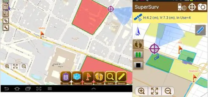
iOS Mapping Solution, SuperSurv, Enhances Raster Data Support
Supergeo releases the latest update of SuperSurv 3.2 (iOS) to enhance the functionality and efficiency for mobile GIS surveyors. Having stronger compatibility with raster dataset and convenient tools for data
Brain of Smart City: A GIS Platform for Sharing 2D and 3D Maps
Smart City, defined as utilizing digital technologies to trim costs and resource consumption to engage its citizens more effectively in various domains like transport, health care, energy, water, and so

SuperGIS 3D Earth Server Updates with Stronger Functionality
Supergeo Technologies, the global leading GIS software and solution provider, releases the latest SuperGIS 3D Earth Server 3.2 with diverse enhancements and structure modifications to elevate user experience of 3D
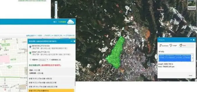
SuperSurv 3.2 Release Advanced GPS Support and Data Collection Functions
Developed by Supergeo, the latest version of SuperSurv (Android) 3.2 is upgraded with stronger data collecting function by GPS and more precise and easy-to-use GPS manipulation interface, bringing
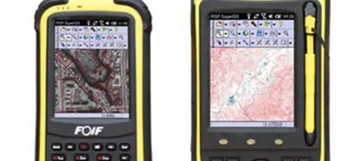
High Accuracy GIS Total Solution by FOIF SuperGIS
Supergeo Technologies, the global leading GIS software and solution provider, announced the cooperation with Suzhou FOIF Co. (FOIF) in providing worldwide surveyors with high accuracy GIS turnkey solution. Mobile GIS
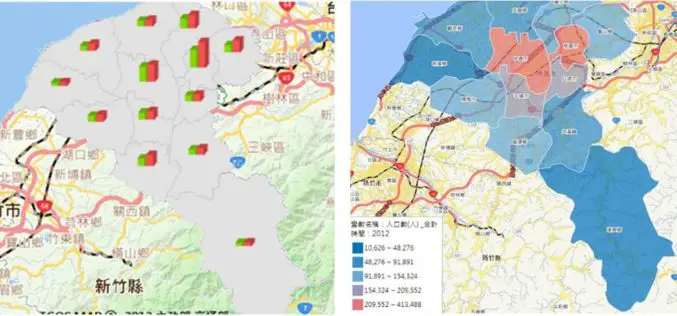
Statistics Map APIs Service Platform
Displaying statistical data on map extends GIS applications to more domains, as it is much easier and more informative for researchers to comprehend meanings of the data through its intuitive
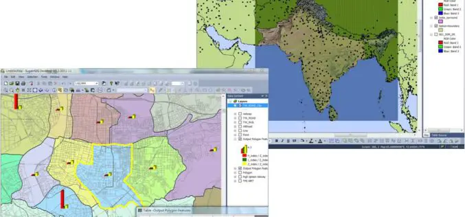
Latest SuperGIS Desktop 3.2 Supports Lidar Data and New Analysis Functions
Supergeo Technologies, the leading global provider of complete GIS software and solutions, releases updated SuperGIS Desktop 3.2, which supports Lidar data and adds more analysis tools. SuperGIS Desktop 3.2 integrates

Supergeo Announces Partnership with T&B Radio Tech in Korea
Supergeo Technologies, the leading global provider of complete GIS software and solutions, authorized T&B Radio Tech, Republic of Korea, as a certified reseller to promote SuperGIS in information communication technology

Esri and E2open Partner to Deliver Market-Leading Supply Chain Solutions
Customers to Benefit from Rapid Demand-Supply Network Visualization on a Global Scale December 8, 2014 Redlands, California—E2open, the leading provider of cloud-based solutions for collaborative planning and execution across global trading
Supergeo Extends Free SuperGIS Desktop License Policy for Students
Supergeo Technologies, the leading GIS software provider, announced the extended policy of free SuperGIS Desktop 3.2 license for students. The universities, colleges and high schools that purchase SuperGIS Desktop Lab
