
Tag "GIS software"

Hexagon Geospatial Launches Power Portfolio 2018
March 01, 2018 – Hexagon Geospatial announces the official release of Power Portfolio 2018. The Power Portfolio helps a wide range of customers Shape Smart Change by providing solutions that harness
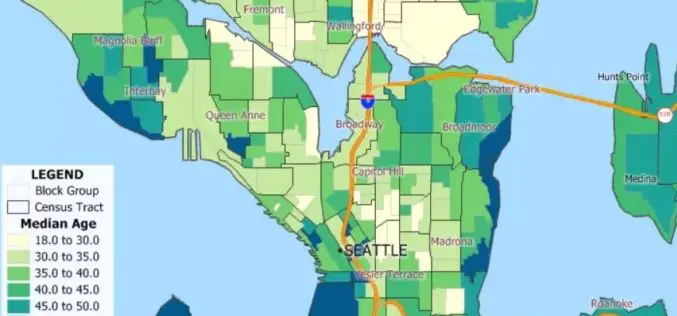
Caliper Offers 2018 Census Block Groups Data
NEWTON MA (USA) – February 28, 2018 – Caliper is pleased to announce that the 2018 U.S. Census Blocks Groups data layer is now available for the entire United States. The 2018 Block

Global Mapper v19.1 Now Available
Global Mapper v19.1 Now Available with 3D Profile Line Exporting, Multivariate Querying, and Expanded Drag-and-Drop Window Docking Blue Marble Geographics is pleased to announce the release of Global Mapper version
GeoCalc SDK 7.4 Update Includes Support for New Projections and JSON Wrapper Classes for Calling to GeoCalc Cloud
Hallowell, Maine – January 23, 2018 – Blue Marble Geographics (bluemarblegeo.com) is pleased to announce the immediate availability of version 7.4 of the GeoCalc Software Development Kit (SDK). This powerful toolkit
Esri Releases World’s First Complete Utility GIS Platform
New Utility Network Management Extension Combines Advanced System of Record with Location-Based Analytics Redlands, California – January 22, 2018 – Esri, the global leader in geographic information system (GIS) technology and spatial analytics,
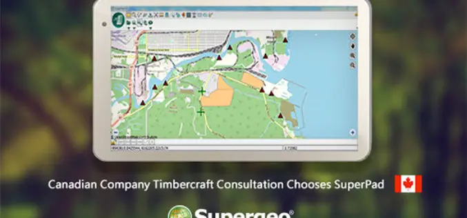
Canadian Company Timbercraft Consultation Chooses SuperPad
The global GIS software provider, Supergeo Technologies Inc., is excited to announce that the Canadian consulting firm Timbercraft Consultation Inc. selects SuperPad to record spatial data. Specialized in geographic data
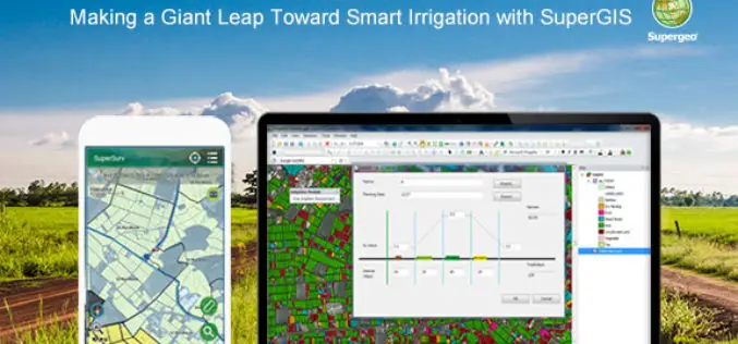
Making a Giant Leap Toward Smart Irrigation with SuperGIS
Geographic Information System (GIS) is becoming extremely popular nowadays for its capability of solving problems in the domains like cadastre management, network analysis, location selection, spatial statistics, etc. to name
Blue Marble Geographics Adds Chinese Reseller to its Worldwide Network of Partners
Hallowell, Maine – December 19, 2017 – Blue Marble Geographics (bluemarblegeo.com) is pleased to announce that Beijing E-Carto Technologies Co., Ltd. has joined the growing list of partner companies reselling and

Supergeo Partners with Agricultural Engineering Research Center to Develop Irrigation Solution
Supergeo is excited to announce that Agricultural Engineering Research Center (AERC), the leading research institute in irrigation study, has collaborated with Supergeo to develop an irrigation solution based on SuperGIS
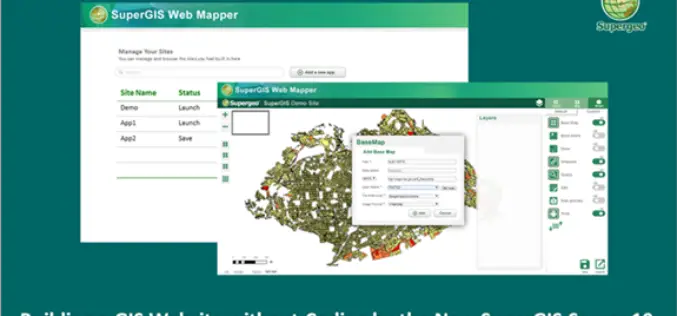
Building a Unique GIS Website without Coding by Brand New SuperGIS Server 10
Supergeo, the global leading GIS software provider, is glad to announce its brand-new GIS server software, SuperGIS Server 10, is expected to be launched in the mid-November! Inheriting the high
