
Tag "GIS app"

Evolve! New Techs for Developer GIS, Meet the Latest SuperGIS Engine 3.3
Supergeo Technologies, the leading global provider of complete GIS software and solutions, officially released SuperGIS Engine 3.3 for global GIS developers to customize GIS applications, meeting diverse demands in various
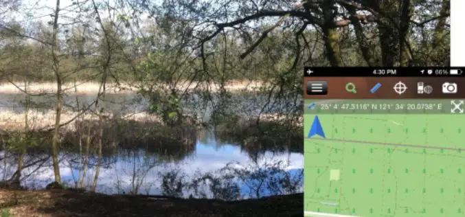
Brandenburg Forest Office, Germany, Select SuperSurv for Forest Conservation
Supergeo Technologies, the leading GIS software and solution provider, announces that Brandenburg Forest Office (Landesbetrieb Forest Brandenburg), Germany has adopted the smart mobile GIS app—SuperSurv to investigate the forest conservation
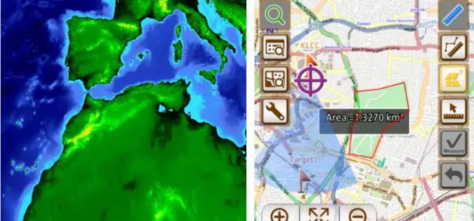
Geosystem ING, the GIS Leader in South America, Enhance Field Survey Solution with SuperSurv
Supergeo Technologies, the global leading GIS software provider, announced that SuperSurv, the smart mobile GIS app for Android and iOS handheld devices, has successfully assisted Geosystem ING, Colombia, in expanding
Embrace Efficiency and Flexibility with Latest SuperGIS Server 3.2
SuperGIS Server is designed to help users share GIS data in many ways, and a better version of SuperGIS Server3.2 just released this week. The latest update improves the management

GEOVISION Utilizes SuperGIS for Maritime and Land GIS Planning
Supergeo Technologies Inc., the leading GIS software and solution provider, announces that GEOVISION, Nouvelle-Calédonie, selects cross-platform SuperGIS series products, SuperGIS Desktop, SuperSurv and SuperVeyor, to elevate its maritime and land

SuperPad Reveals NTRIP Solution to Achieve Centimeter Level Accuracy
Supergeo, the leading GIS software and solution provider, is going to release NTRIP solution on its Windows Mobile GIS app, SuperPad, for high accurate field data collection and geospatial workflow

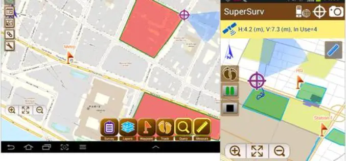
High Accuracy and Advanced Field Work with Latest SuperSurv
To meet the great needs of high accuracy field data collection and better workflow via modern GNSS technology, Supergeo, the leading GIS software and solution provider, announces the latest SuperSurv

iOS Mapping Solution, SuperSurv, Enhances Raster Data Support
Supergeo releases the latest update of SuperSurv 3.2 (iOS) to enhance the functionality and efficiency for mobile GIS surveyors. Having stronger compatibility with raster dataset and convenient tools for data
SuperSurv 3.2 Release Advanced GPS Support and Data Collection Functions
Developed by Supergeo, the latest version of SuperSurv (Android) 3.2 is upgraded with stronger data collecting function by GPS and more precise and easy-to-use GPS manipulation interface, bringing
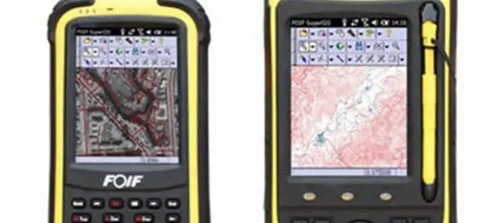
High Accuracy GIS Total Solution by FOIF SuperGIS
Supergeo Technologies, the global leading GIS software and solution provider, announced the cooperation with Suzhou FOIF Co. (FOIF) in providing worldwide surveyors with high accuracy GIS turnkey solution. Mobile GIS
