
Tag "geospatial"
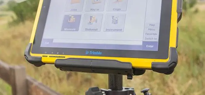
Trimble Introduces High-Performance T10 Tablet for Geospatial Field Applications
BERLIN, Sept. 26, 2017—Trimble (NASDAQ: TRMB) introduced today the Trimble® T10 tablet, a rugged, high-performance data processing platform suitable for a variety of survey and Geographic Information System (GIS) applications.
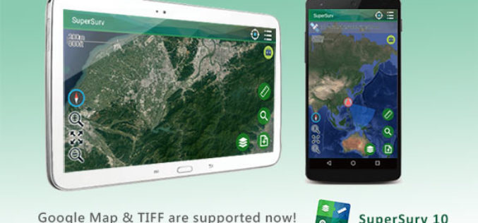
SuperSurv 10.1 Supports New Raster Formats and Online Maps
As the information technology constantly evolves, the geospatial industry also grows fast. Currently, including many open source projects, numerous services are providing online maps to geospatial professionals. As professional and

Introducing Trimble Clarity – A Cloud-based Geospatial Data Viewer and Collaboration Product
Introducing Trimble Clarity – A Cloud-based Geospatial Data Viewer and Collaboration Product September 27, 2017 Join us live from the Intergeo Geospatial Conference in Berlin, Germany as we present Trimble
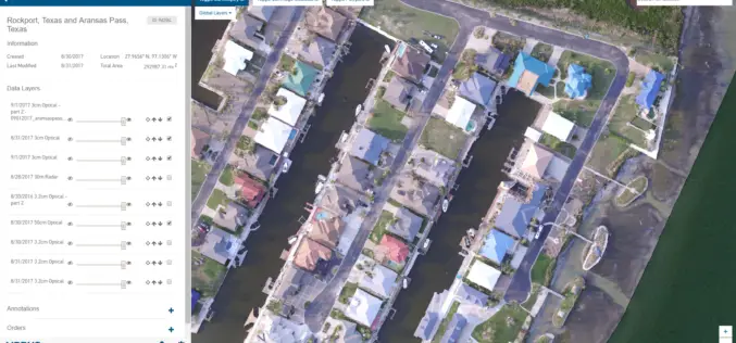
New Airbus Aerial Technology Impacts Hurricane Irma Recovery Efforts
September 12, 2017 – As residents and insurers in the southeastern United States begin to consider recovery efforts following Hurricane Irma, Airbus Aerial is prepared to help by providing insurance

PCI Geomatics Releases Geomatica 2017, Service Pack 1
MARKHAM, Ontario, Canada, September 12, 2017 – PCI Geomatics, a world leading developer of remote sensing and photogrammetric software and systems, announced today the release of Service Pack 1 for

Indian Railways to Install GPS in all Hand-pushed Trolleys Used for Track Inspection
September 8, 2017 – PTI – The railway ministry has decided to install GPS trackers in all hand-pushed trolleys used to inspect the tracks. In a letter to all zonal

OGC Approves Community Standard for Streaming 3D Content
September 06, 2017 – The Open Geospatial Consortium (OGC®) membership has approved a new 3D standard for content strategy. This standard is focused on high performance visualization and spatial analysis

Pix4D Among UAV Industry Leaders Intel® Uses to Launch Intel Insights Platform
September 7, 2017 – Yesterday at InterDrone, Intel CEO Brian Krzanich announced the new Intel Insight Platform that will allow select enterprise customers to accelerate the path from drone flight to
OGC Seeks Public Comment on Proposed Geocoding API Standards Working Group
September 5, 2017 – The Open Geospatial Consortium (OGC®) is requesting comments on the draft charter for an OGC Geocoding API Standards Working Group (SWG). Geocoding is the act of linking

DigitalGlobe Delivers WorldView-4 High-Resolution Satellite Imagery to Power PSMA Australia’s Continent-scale Mapping Initiative
WorldView-4 Imagery To Become Available To All Commercial Customers On August 31 WESTMINSTER, Colo.–(BUSINESS WIRE)–Aug. 29, 2017– DigitalGlobe, Inc. (NYSE: DGI), the global leader in Earth imagery and information about our changing planet,

