
Tag "Geophysical Reference Model"
GIS
3D Geophysical Exploration Model Covers All South Australia
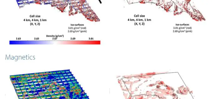
Integrating 3D geophysical data to a depth of 100 km The South Australian Geophysical Reference Model allows users to bring to life the state’s vast resource data sets of geological
