
Tag "GeoNews"

Vricon among First Companies on GSA Earth Observations Solutions
McLean, VA – 14 August 2017 –Vriconannounced today that it is among the first companies to offer GEOINT solutions on the General Services Administration’s (GSA) new Earth Observations Solutions Special
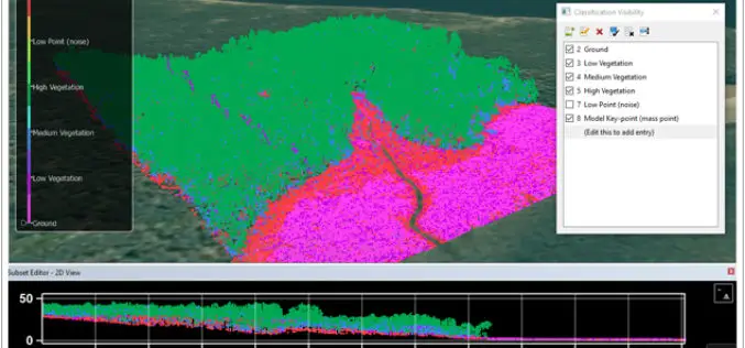
CARIS Bathy DataBASE 4.4 Released
Fredericton, NB, Canada – August 09, 2017 – Teledyne CARIS™ is pleased to announce the release of Bathy DataBASE™ (BDB) 4.4. This new version addresses the important areas of feature generalization

Velodyne LiDAR Appoints Robert Brown as Chief Financial Officer
August 08, 2017 – SAN JOSE, Calif.–(BUSINESS WIRE)–Velodyne LiDAR Inc., the world leader in 3D real-time perception systems for autonomous vehicles, today announced Robert (Bob) Brown has joined the company as

Tamil Nadu Government Started UAV Survey to Map Flood-Prone Areas
According to recent news by The Hindu, the Tamil Nadu Government in association with Anna University has launched an Unmanned Aerial Vehicle (UAV) for Photogrammetric mapping of water resources in Cuddalore
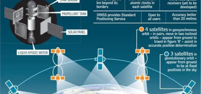
Isro to Sign MoU with CSIR-NPL for Time and Frequency Traceability Services for NavIC
According to recent news reported by TOI, the Indian Space Research Organisation (ISRO) will on Friday sign an MoU with CSIR-National Physical Laboratory (NPL) for time and frequency traceability services. The move

Geovation Programme Now Open to Location and Land Disruptors
The Geovation Programme is now accepting applications from start-ups using location and/or land and property data in their products and services. 01 August 2017 – A new generation of location

Boeing and JAXA to Flight-test Technology to Improve Safety
SEATTLE, Aug. 2, 2017 /PRNewswire/ — Boeing [NYSE: BA] and the Japan Aerospace Exploration Agency (JAXA) will flight-test Long-range Light Detection and Ranging (LIDAR) technology next year. This remote-sensing technology could help commercial

FAA Administrator Michael P. Huerta to Deliver Grand Opening Keynote Address at InterDrone
Heads stellar lineup of keynotes at commercial drone industry’s largest dedicated event MELVILLE, N.Y., July 31, 2017 — BZ Media LLC today announced that Michael P. Huerta, Administrator of the
USACE Mobile District Signs WMR-532 to $46M Coastal Mapping Contract
WMR-532, the joint venture of Woolpert and Optimal Geo, will provide bathymetric and topographic lidar and imagery in support of JALBTCX task orders around the world. DECATUR, Ala. (July 26,

OGC is Calling for Sponsors for an Innovative Interoperability Initiative, Testbed 14
Thursday, 27 July 2017 – The Open Geospatial Consortium (OGC®) has issued a call for sponsors for an innovative interoperability initiative, Testbed 14. The OGC Innovation Program provides a venue
