
Tag "Geological Survey of India"
Geological Survey of India to Complete Landslide Susceptibility Mapping in 2018
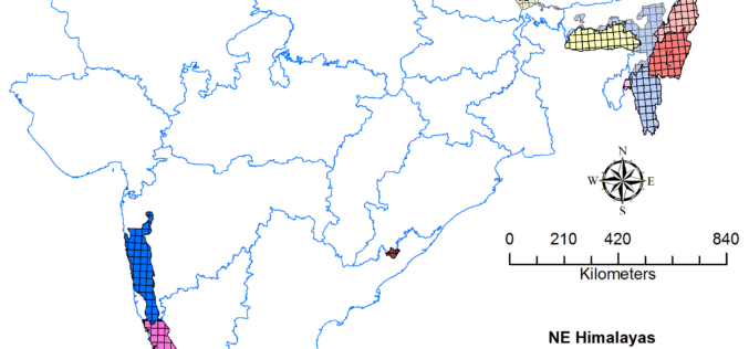
Kolkata, December 6, 2017 (IANS) : The Geological Survey of India (GSI) is set to complete generation of Landslide Susceptibility Maps – covering an area of 1.71 lakh sq km

JNARDDC and MRSAC are Developing Bauxite Mining App
Nagpur-India: According to recent news by The Times of India, the Jawaharlal Nehru Aluminium Research Development and Design Centre (JNARDDC), Nagpur, in collaboration with the Maharashtra Remote Sensing Application Centre (MRSAC),
Geological Survey of India Finds Huge Gold Deposits
Karnataka – According to recent news by the Deccan Herland, the Geological Survey of India (GSI) has found large gold deposits spread over 600 sq km between Shikaripur in Shivamogga
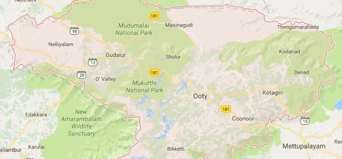
Geological Survey of India to Map Landslide-prone Zones in Nilgiris
According to recent news by TOI, almost three years back the Geological Survey of India (GSI) has started the process of mapping landslide-prone zones in the Nilgiris (Western Ghats of India),
Geological Survey of India to Map Geological Potential Areas of the Country
Geological Survey of India (GSI) will soon take up the ambitious National Airborne Geophysical Mapping project covering 8 lakh sq kms including the Obvious Geological Potential (OGP) area, which includes
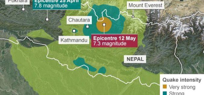
Geological Survey of India Mapping Nepal Earthquake Aftershocks
In a bid to aid community preparedness, scientists at the Geological Survey of India (GSI) are monitoring the aftershocks in various parts of the country following the massive April 25
