
Tag "GeoJSON"
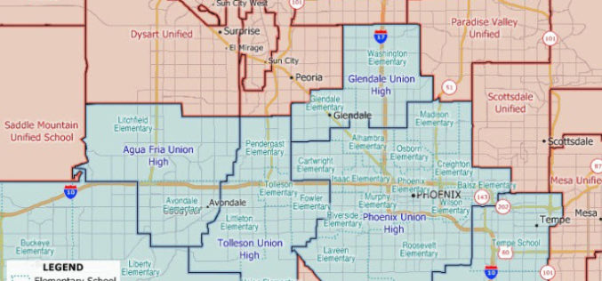
Maptitude 2020 U.S. School Districts Data Available as KML, GeoJSON, Shapefile
The Maptitude 2020 U.S. School Districts Data is available and includes three nationwide map layers of elementary, secondary, and unified school districts.

Work Easier with Satellite Images – LandViewer Launches New Features
MENLO PARK, Calif. – The California-based company EOS have launched cloud based tool LandViewer, that allows non-expert users to select a geographic area for analysis, an earth observation data types,
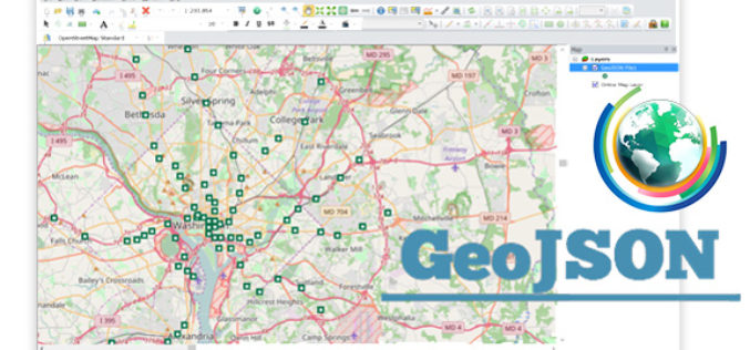
Embrace GeoJSON Format Together with SuperGIS Desktop
In recent years, as value-added services get increasingly popular in IT industry and civic engagement becomes a new trend in governance, the idea of Open Data turns out to be
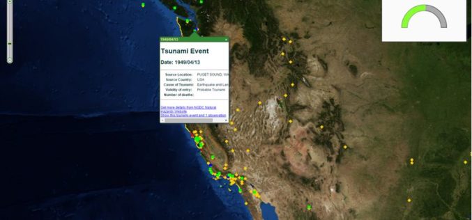
The Regeneration of Open Data through SuperGIS Server
Integrating different sources of open data often generates great value and new information. For example, by integrating earthquake and tsunami locations with a coastal city vulnerability index, you will be
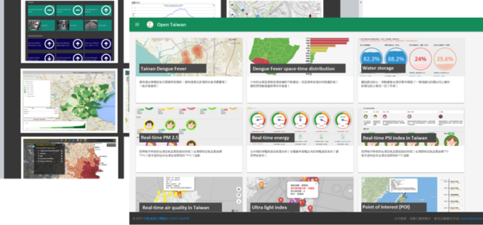
A World of Open Data
Nowadays, people are asking eagerly for Open Data and Open Government in order to gain access to unmediated facts and knowledge. Open data is, in fact, not a new idea.
Using Vector tiles Facilitate Your Mapping Experiences
One of all GIS products that Supergeo Technology has been devoting to developing, implementing and promoting for the world, SuperGIS Desktop 10, is going to be launched for global users.

Online Vector and Raster Converter Tool
MyGeodata Converter is an online tool that allows you to read and write from/to a huge number of CAD and GIS formats – both vector and raster. In contrast to
