
Tag "Geographic Information Systems"
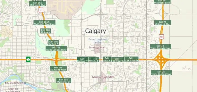
Free Highway Exits & Interchanges Data for Use with Maptitude 2018
Newton, Massachusetts (USA) – Caliper is excited to announce the release of new highway exit data for the United States and Canada. Users of Maptitude 2018 with the Canada or United States

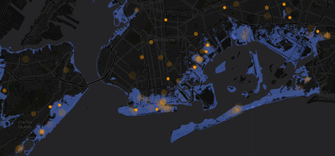
thinkWhere Takes a Global View with theMapCloud Platform
Stirling, Scotland, January 17, 2018 – Scottish Geographic Information Systems (GIS) company thinkWhere is setting its sights on global expansion with the launch of a new cloud-based platform for GIS and

Presagis Introduces New Automated Virtual Environment Production Solution
November 27 2017 – Montreal, Canada – Presagis™, a recognized leader in modeling and simulation software, today introduced VELOCITY, a next-generation software solution that automates the production of large synthetic training

CompassDrone™ to Demo Integration of DJI Video with ArcGIS at Esri Mapping Forum
CENTENNIAL, Colorado, 29 June 2017 – Full motion video (FMV) captured by the best-selling drones in the world can now be viewed, queried and used for professional mapping projects in Esri ArcGIS.

Siemens and Bentley Systems Agree to Jointly Offer Planning and Design Solutions for Utilities
San Diego, U.S.A. – DistribuTECH 2017 – Building on the strategic alliance between Siemens and Bentley Systems that was made public in November 2016, Siemens’ Energy Management Division and Bentley

Two UN Agencies Adopted Geospatial Technologies to Protect Cultural Heritage
Two United Nations agencies (UNOSAT and UNITAR) have signed an agreement to protect cultural and natural heritage sites by using the latest geospatial technologies, including a satellite imaging system. The

Abu Dhabi Municipality Launches GIS Platform for Submittal of Road Layout Data
In a major boost and expansion to the e-services, The Abu Dhabi City Municipality (ADM) has launched a platform that allows submittal of roads layout data standards using Geographic Information

Esri Webinar: Effective Vector-Borne Disease Surveillance and Control
Esri Webinar: Effective Vector-Borne Disease Surveillance and Control Thu, May 26, 2016 11:30 PM – Fri, May 27, 2016 12:30 AM IST Show in My Time Zone Understanding the complete
Pratt Institute Announces the Spatial Analysis and Visualization Initiative
On April 28, Pratt Institute will celebrate the official opening of the Spatial Analysis and Visualization Initiative (SAVI), the Institute’s research lab and service center focused on Geographic Information Systems
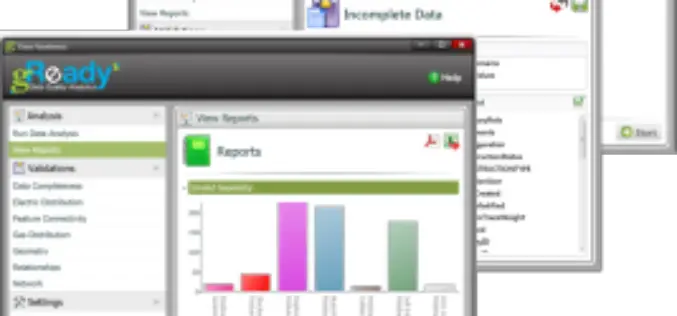
RAMTeCH Optimizes GIS Data Quality with gReady
RAMTeCH Software Solutions, Inc., a global leader in spatial enterprise solutions, introduces its gReady™ data quality analytics software solution to help uncover, prioritize and correct operational data quality errors in Geographic Information

