
Tag "Geographic Information System"

Geospatial Innovation in Spotlight at Esri Conference in DC
NGA Director Robert Cardillo and Former Maryland Governor Martin O’Malley to Keynote Redlands, California—Technology and government leaders will gather for the Esri Federal GIS Conference in Washington, DC, February 9–10,
SuperGIS Cache Generator Now Supports STP Format
Supergeo announces that Cache Generator, the built-in tool in SuperGIS Desktop 3.2, now supports STP format, as a faster alternative to STC and XML files, for users to experience a

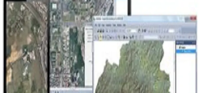
SuperGIS Helps National Research Council of Italy to Analyze Earth System
Supergeo Technologies, the global leading GIS software and solution provider, announced that Institute of Geosciences and Earth Resources, National Research Council of Italy (CNR) utilizes SuperSurv and SuperGIS Desktop to

iLOOKABOUT Corp. Announces Conversion of Unpaid Dividends to Common Shares
LONDON, ON–(Marketwired – January 02, 2015) – iLOOKABOUT Corp. (TSX VENTURE: ILA) (“iLOOKABOUT” or “the Company”) announced today that, subject to the approval of the TSX Venture Exchange, the Company
Washington Suburban Sanitary Commission Enhances Customer Service with Esri Enterprise System
Redlands, California—Nearly two million people stand to benefit from significant technological improvements made by Washington Suburban Sanitary Commission (WSSC), one of the largest water and wastewater utilities in the country.

OGC seeks public comment on KML 2.3 standard
19 December 2014 – The membership of the Open Geospatial Consortium (OGC®) seeks public comment on the candidate OGC KML 2.3 Standard. KML is an XML grammar used to encode
3D Laser Mapping Scanner Helps UCL Scientists Map Trees
A state of the art laser scanner purchased from 3D Laser Mapping is helping scientists at University College London accurately monitor and record the state of forests around the world.

ThinkGeo Releases Map Suite for Android, iOS and WebAPI
Frisco, TX — ThinkGeo is proud to announce the additions of Map Suite WebAPI , Map Suite for Android and iOS platforms to the Map Suite family of products. These

PhD in Mobile Imaging Sensors Using Airborne Imagery at ITC
The University of Twente, we stand for life sciences and technology. High tech and human touch. Education and research that matter. New technology which drives change, innovation and progress in
Battlespace Simulations, Inc. (BSI) Providing Modern Air Combat Environment to U.S. Armed Forces
TatukGIS customer Battlespace Simulations (BSI) is increasingly successful licensing its flagshipModern Air Combat Environment (MACE) to the U.S. Armed Forces for simulated combat training and mission rehearsal. MACE provides computer
