
Tag "flood mapping"
HARRIS Geospatial Solutions Webinar: The Applications and Benefits of Synthetic Aperture Radar (SAR)
Synthetic Aperture Radar (SAR) is rapidly becoming a key dataset in geospatial investigation. Unlike many other observational methods, SAR is not limited by illumination or cloud cover. In recent years,
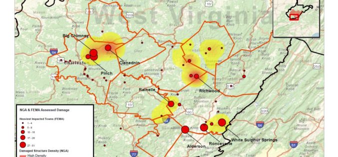
National Geospatial-Intelligence Agency Provides Expertise Response to West Virginia Flooding
As reported in a recent news bulletin by The National Geospatial-Intelligence Agency (NGA), NGA is providing geospatial expertise and damage assessments to the Federal Emergency Management Agency (FEMA) for flooded

Odisha Goes for Flood Mapping
According to recent news by The New Indian Express, the Odisha State Disaster Mitigation Authority (OSDMA) has released a Flood Inundation Mapping (FIM) for Kendrapara, a coastal district of Odisha.
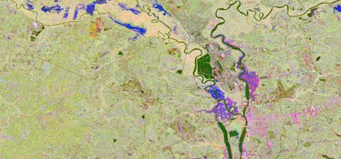
Contour Mapping for Flood Free Mumbai
According to recent news by the Hindustan Times, Maharastra Chief Minister Devendra Fadnavis has informed in State Assembly that contour mapping will be made mandatory for builders who seek permission

Bhuvan Tamil Nadu FS: A Mobile App to Monitor Flood Situation
Bhuvan Tamil Nadu FS App is a user-friendly mobile application which enables to collect and report for geo-tagged of flood information on various parameters such as type of damage and
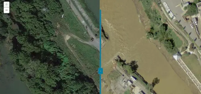
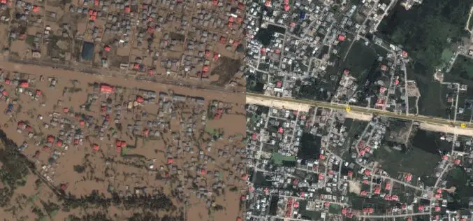
Imagery Assists Disaster Response in South Carolina
COLUMBIA, S.C. (Nov. 4, 2015) — One month ago today, a “thousand-year” rain event hit South Carolina, spurring widespread flooding throughout much of the state. In an effort to address the
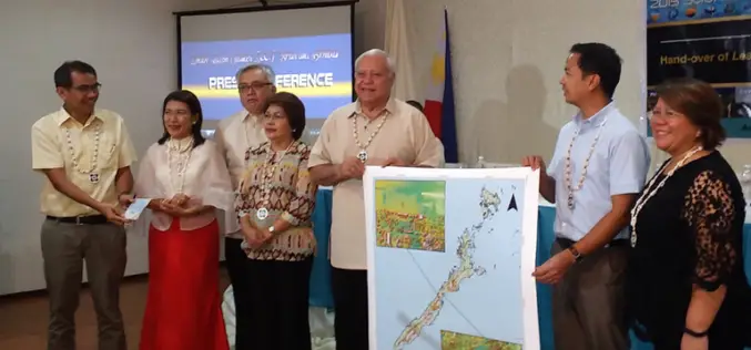
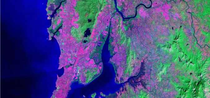
Philippines Uses LiDAR for Flood Hazard Mapping
Palawan is one of the many provinces of the Philippines that benefited from the flood hazard mapping project. The project was initiative of Department of Science and Technology’s (DOST). Recently
Accuracy Comparison of Publicly available DEMs and LiDAR DEM for Coastal Flood Risk Assessments
Coasts are experiencing the adverse consequences of hazards related to climate change and sea level rise and will be exposed to increasing risks of coastal flooding. Ten percent of the

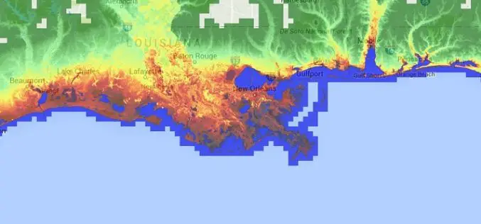
FEMA Release Guidelines for Coastal Flood Hazard Analysis and Mapping
The U.S. Federal Emergency Management Agency has issued Guidelines for Coastal Flood Hazard Analysis and Mapping for the Pacific Coast of the United States. FEMA’s mission is to support citizens and
J&K Moves for Geospatial Modeling of Rivers for Flood Preparedness
J&K was severely affected by flood in September 2014, learning the lesson from past the J&K Government is planning to prepare 3D maps of terrain using geospatial techniques. Digital Elevation
