
Tag "European Space Agency"
INSPIRE WCS Adopted
Last month INSPIRE officially adopted the OGC Web Coverage Service (WCS) as INSPIRE Coverage Download Service. Jordi Escriu, Facilitator of the corresponding Thematic Cluster 3, calls “WCS the natural way
Sentinel Imagery Now Works Inside ArcGIS
Redlands, California—Esri enhanced its ArcGIS technology to simplify the use of free global imagery from the Sentinel-2 satellite launched by the European Space Agency. ArcGIS supports visualization, interpretation, and analysis
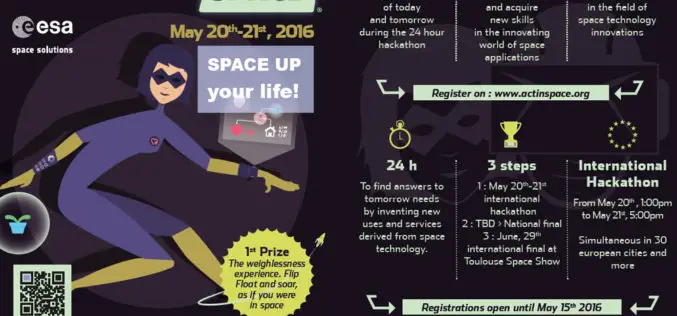
ActInSpace: The Space Technology Challenge
Airbus Defence and Space is partnering with the French and European space agencies (CNES and ESA*) to organise ActInSpace. ActInSpace is a 24-hour contest where anyone can join a team
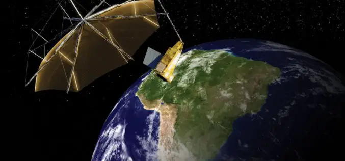
Airbus Defence and Space to Build Biomass – the European Space Agency’s Forest Mission
1st P-band radar in space will measure the amount of biomass and carbon locked in the world’s forests and how this changes over time Biomass satellite will provide support to
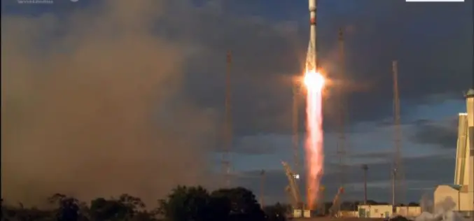
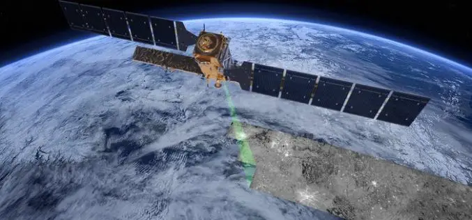
Sentinel-1B – Second Eye of the Earth Guardian in Orbit
Dual launch for European environmental satellite and MicroSCOPE small satellite mission Two eyes are better than one; this principle is also true for the two radar satellites that make up
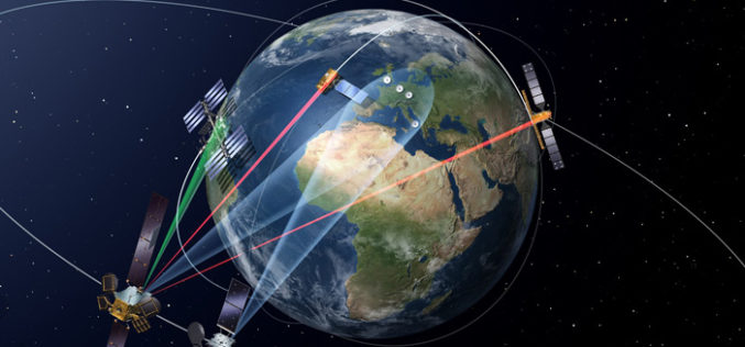
Launch of the First Satellite in the “SpaceDataHighway” Programme
SpaceDataHighway will provide high-speed laser communication in space of extremely high volumes of data transfer, up to 50 terabytes per day EDRS-A, the first relay satellite in the SpaceDataHighway programme
The “Radar Vision” Goes On – Two More Sentinel-1 Satellites
– Airbus Defence and Space signs €143M contract with Thales Alenia Space – New Sentinel instruments ensure services for Copernicus beyond 2029 Airbus Defence and Space, the world’s second-largest space
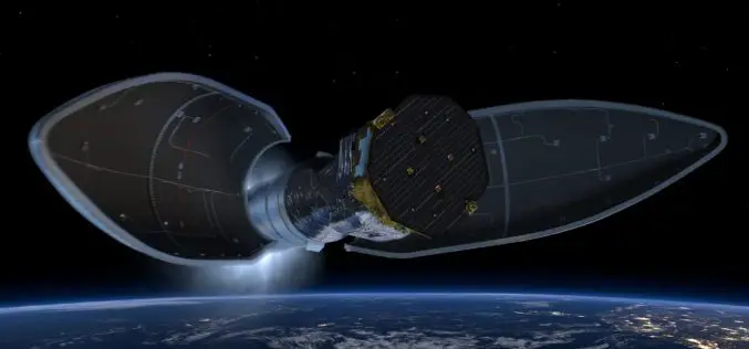
In The Footprints of Albert Einstein – Successful Launch of LISA Pathfinder
The science and technology demonstrator LISA Pathfinder lifted off from Europe’s Spaceport in Kourou, French Guiana on board a Vega rocket at 05:04 CET on 3 December 2015. Preparations for
Successfully Launched Sentinel-2A will Provide Colour Vision of Earth
– Satellite built by Airbus Defence and Space to add colour to the Copernicus programme through multispectral instrument that provides unique image quality – Laser-based data transmission via new SpaceDataHighway

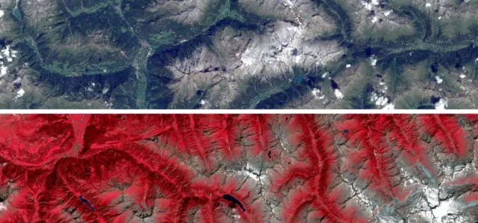
European Space Imaging High-Res Urban Challenge & Win Imagery Worth EUR 20,000
The European Space Imaging High-Res Urban Challenge gives a sneak preview on this very high-resolution imagery (40 cm, 8-band) collected by European Space Imaging (EUSI) recently, the data corresponding to
