
Tag "Earthquake"
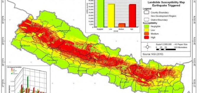
Nepal: Pilot Project on Landslide Hazard Mapping
Kathmandu – According to recent news by The Himalayan Times, the Department of Soil Conservation and Watershed Management, Nepal has started a pilot project of landslide hazard mapping from Dolakha
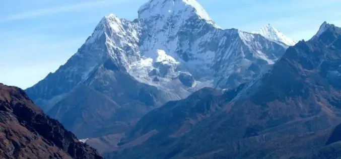
Mount Everest Moved 3 cm, Height Not Affected By Nepal Earthquakes
Beijing: Mount Everest moved three cms during the recent devastating earthquakes in Nepal but contrary to earlier reports the height of world’s tallest mountain has not been affected, Chinese official monitoring
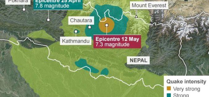
Geological Survey of India Mapping Nepal Earthquake Aftershocks
In a bid to aid community preparedness, scientists at the Geological Survey of India (GSI) are monitoring the aftershocks in various parts of the country following the massive April 25
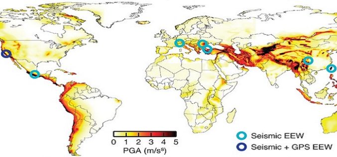
Crowdsourcing to Facilitate Earthquake Early Warning Implementation to Reduce the Impact of Future Earthquakes
The 7.9-magnitude earthquake that struck Nepal on August 25, 2015 has killed more than 5,000 people. Many thousands have been injured and hundreds are still missing or trapped under rubble.

3D Laser Mapping Helps Preserve Earthquake Prone Buildings in New Zealand
New Zealand based Solutions By Zeal is reaping the rewards of using the ZEB1 hand held laser mapping system to survey buildings at risk from earthquakes or in need of
