
Tag "Drone"

PrecisionHawk Launches Free PrecisionMapper Software for Drone Mapping
Now drone operators can stitch an unlimited number of photos, create maps without resolution limits and run algorithms to analyze their data for free PrecisionHawk, a leading commercial drone and
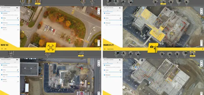
6 Major Construction Companies Adopt New Bim Monitoring Solution
Construction professionals understand that daily visualization of a job site helps minimize construction delays, prevent clashes between as-built and as design, eliminate the need for rework, facilitate stakeholder communication and
Comparable Maps, Anytime, Thanks to Pix4D and Sequoia Sunshine Sensor
Consistent Index Maps When you are a service provider with high client expectations, you need to be able to obtain quality results on a regular basis. When it comes to

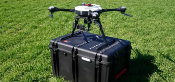
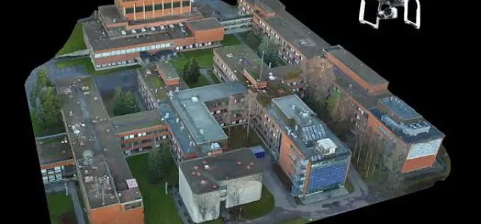
SimActive and Tianlifa Launch Integrated UAV Solution
Montreal, Canada, March 21st, 2017 – SimActive Inc., a world-leading developer of photogrammetry software, is pleased to announce a fully-integrated solution with Tianlifa, a major firm in the Asian surveying

The Power of Offline Processing: Why Desktop is Essential for Drone Mapping in Agriculture
Part 2: Processing in the Field In Part 1 of this mini-series we went over why it makes sense in agriculture to import images directly to Pix4Dag Desktop. We concluded that
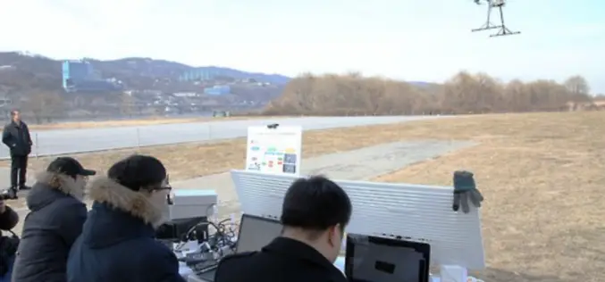
South Korea Government Using Drones to Map Hazardous Areas
According to recent news by Korea Bizwire – On Tuesday, the Ministry of Land, Infrastructure and Transport demonstrated its latest 3D-mapping technology that makes use of drones, at the Han River
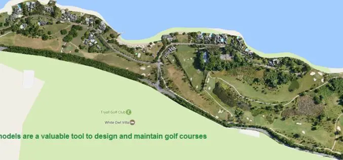
Three Reasons Golf Courses Are the Next Drone Mapping Territory
The emerald golfing greens have seen better days. According to the US National Golf Foundation, the number of players has almost steadily declined from over 30 million in 2005 (pre-recession),

senseFly Webinar: Ag Drone Insights
Ag Drone Insights Experienced agronomists discuss UAV applications, results, ROI & more Tuesday, JAN 24, 2017 In this webinar you will learn: How to choose, adopt, & operate drone tech The

“UNMANNED WORLD”, the first and most complete Exhibition of Unmanned Vehicles in Middle East will take place at Qatar in April 2017
Unmanned World will gather Robotics and Unmanned ground and surface vehicles (UGV & USV), Remotely Operated Vehicles (ROV) and Unmanned Aerial Vehicles UAV, which are one of the largest investment opportunities worldwide. Unmanned
Drone That Can Create a Perfect 3D Map of Any Town – And May Help Set up 5G Networks
London, According to recent news reported by the PTI, Remote-controlled drones can be used to create an accurate 3D model of an urban area and design wireless networks, scientists say,
