
Tag "Drone Surveying"

Business
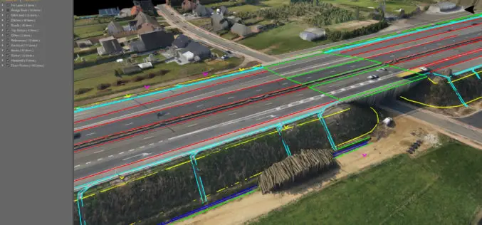
Virtual Surveyor to Unveil Enhanced Cut-and-Fill Mapping in Drone Surveying Package at InterGEO 2019
Faster, More Accurate Volume Calculations LEUVEN, Belgium, 10 September 2019 – Virtual Surveyor has added cut-and-fill mapping capabilities to Version 7.0 of its popular drone surveying package. The new functionality
Business
Software
Virtual Surveyor Streamlines Workflow, Enhances User Experience with New Version of Drone Surveying Software
LEUVEN, Belgium, 10 July 2018 – The Virtual Surveyor drone surveying software now offers a faster, more efficient workflow and better overall user experience in a more stable platform. These
