
Tag "Bhuvan"
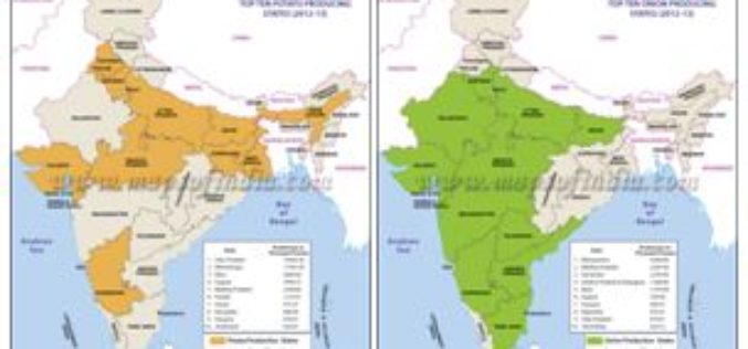
Agriculture Ministry Plans to Utilize Remote Sensing to Map Potato & Onion Cultivation Area
NEW DELHI: According to recent news by The Economic Times, the agriculture ministry is planning to use remote sensing technology to map the area under potato and onion cultivation for
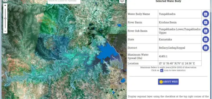
Temporal Repetitive Mapping of Water Bodies Across India
National Remote Sensing Centre (NRSC), ISRO at Hyderabad monitors the status of all the water bodies in the country using satellite images and provides water spread area information on a

Satellite Reveals Decline in the Number of Forest Fires in Uttarakhand
According to recent news by The Hindu, Satellite images show that there’s been a decline in the number of forest fires in Uttarakhand since April 28. Though fires in the
Railway Land Management Module to Tackle Encroachment Menace
Railways have developed a web-based application called Land Management Module to provide the status of rail land whether encroached or not which would be helpful in tackling the menace of
IBM and NRSC Signed MoU for Monitoring Mining Activity
According to recent news, Indian Bureau of Mines (IBM) and National Remote Sensing Centre (NRSC) has signed Memorandum of Understanding (MoU) for monitoring mining activity through satellite technology. The MoU was
Bhuvan – Training Explaining the Functionalities and Utilities of Bhuvan
Training is offered on Bhuvan Visualization, Services and Collaborative Applications. In order to increase the awareness on Bhuvan, attract Academicians to participate in crowdsourcing & development and initiate Government agencies
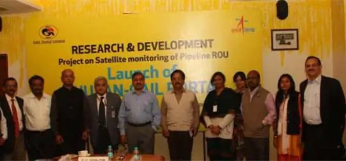
GAIL and ISRO Joins Hands for Satellite Monitoring Of Pipelines
To address pipeline safety concerns, GAIL (India) Limited in collaboration with National Remote Sensing Centre (NRSC) – a unit of Indian Space Research Organization (ISRO) – has launched an innovative
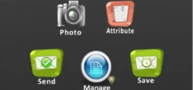
Bhuvan Tamil Nadu FS: A Mobile App to Monitor Flood Situation
Bhuvan Tamil Nadu FS App is a user-friendly mobile application which enables to collect and report for geo-tagged of flood information on various parameters such as type of damage and
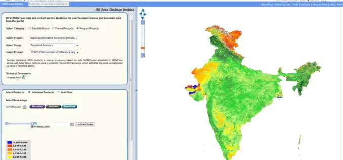
Bhuvan Updates | OGC Services, Active Agricultural Fire Locations, Snow Albedo, Filtered NDVI
Bhuvan, (lit: Earth), is a software application which allows users to explore a 2D/3D representation of the surface of the Earth. The browser is specifically tailored to view India, offering
Join Free Training on Bhuvan – Gateway to Geospatial World
Training on Bhuvan – Gateway to Geospatial World December 08 – 09, 2015 Bhuvan, (lit: Earth), is a software application which allows users to explore a 2D/3D representation of the
