
Tag "BAE Systems"
Business
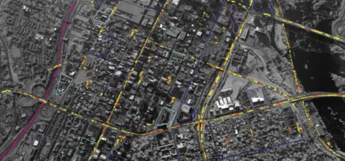
BAE Systems Enhances Geospatial Software by Adding Movement Intelligence Capabilities
SAN DIEGO–(BUSINESS WIRE)–BAE Systems has integrated capabilities called Movement Intelligence, or MOVINT, into its Geospatial eXploitation Products™ (GXP®) line of software, helping analysts to more easily identify intelligence threats using

Business
BAE Systems to Develop Airborne Mine-Hunting LIDAR for Manned and Unmanned Aircraft
Electro-optics engineers at BAE Systems are designing a multi-sensor suite and onboard processing to detect, identify, and pinpoint moored and drifting sea mines from manned and unmanned aircraft. Officials of the

Business
Software
BAE Systems Unveils Geospatial Intelligence Mobile App for Google Glass
BAE Systems today unveiled a new mobile app that can be used with Google Glass for hands-free geospatial intelligence data collection and photo reporting from anywhere in the field. Apr
