
Tag "arcgis"
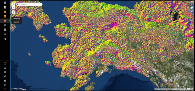
NGA Releases Biggest Collection of Arctic Elevation Data Yet at Esri FedGIS Conference
ArcticDEM Provides High-Quality Elevation Data and Enables Communities to Take Action Redlands, California—Esri, the global leader in spatial analytics, together with the ArcticDEM project—a public-private initiative to produce high-resolution, high-quality
TerraGo Webinar: How to Build Custom ArcGIS Mobile Apps with Zero-Code
Webinar Workshop: How to Build Custom ArcGIS Mobile Apps with Zero-Code March 7, 2017 | 12:00 PM (ET) TerraGo Magic® enables anyone to rapidly build private-label, custom ArcGIS apps without the
Download for Free – Esri Release ArcGIS Earth 1.4
Recently Esri 3D team has announced the release of ArcGIS Earth 1.4. ArcGIS Earth 1.4 introduces great new features that will enhance workflows for visualizing data, accessing portals, and sharing across
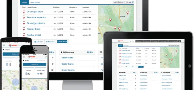
Esri Releases Advanced Analytics to Increase Retail Sales
Indoor Spatial Analysis of Consumer Behaviors Boosts Profits and Increases Customer Satisfaction January 17, 2017 – Redlands, California—Esri, the global leader in spatial analytics technology, today announced a partnership with GISinc

Avenza MAPublisher Now Features ArcGIS Online Integration within Adobe Illustrator
Connect to ArcGIS Online within Adobe Illustrator to import and work with data layers Toronto, ON, January 4, 2017 – Avenza Systems Inc., producers of the Avenza Maps app for
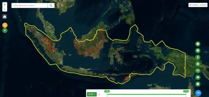
Indonesia Launches Geospatial Portal for Forest Monitoring and Protection
Indonesia – According to recent news by the Eco-Business, the Ministry of Environment and Forestry has launched a new geospatial portal, which will serve as the dedicated and reliable source
Esri Boosts Higher Education in Ethiopia
Company Donates Cloud-Based GIS Solutions to More Than 30 Schools Redlands, California—Smart mapping leader Esri announced an agreement between Esri Eastern Africa Limited and the Federal Democratic Republic of Ethiopia
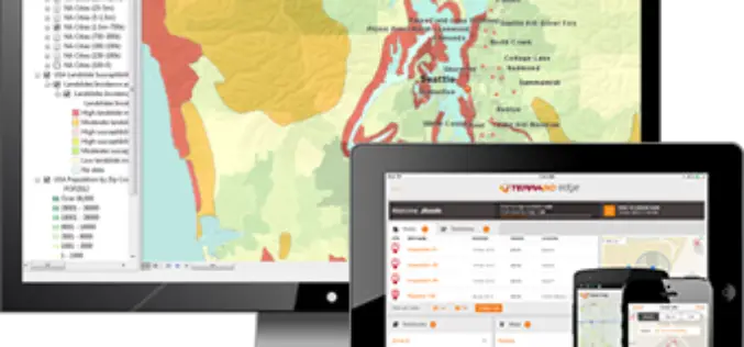
TerraGo Webinar: Connect your ArcGIS with the Edge of the Enterprise
Webinar: Connect your ArcGIS with the Edge of the Enterprise November 15, 2016 | 12:00 PM (ET) Maximize your ArcGIS investment and reach a wider mobile audience, while improving field data

Esri Chosen by Microsoft as its GIS Service for Enterprise Users
A New World of Analytics Available to Power BI and Azure Users Redlands, California—Esri, the world leader in geographic information system (GIS) technology, is collaborating with Microsoft Corp. on two

Esri Webinar: Transform Conservation with Drone2Map for ArcGIS
Conservationists are being called on to do more with less. In the face of climate change, widespread pollution, and urbanization, conservation has become paramount to the health and well-being of
