
Tag "aerial photography"
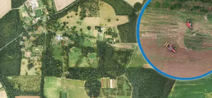
Bluesky Aerial Photomaps Help Outfield Reveal Secrets to Improving Farm Management
December 4, 2018 – Ultra high-resolution aerial photography and 3D landscape models from Bluesky are helping Outfield Technologies develop innovative image recognition techniques to improve agricultural land management and crop
Col-East Taps Extensive Image Archive to Create Multi-Function Maps
NORTH ADAMS, Massachusetts, 4 October 2017 – Col-East International Ltd., a provider of aerial photogrammetric services in the Northeast U.S. since 1952, tapped into its extensive archive of aerial imagery
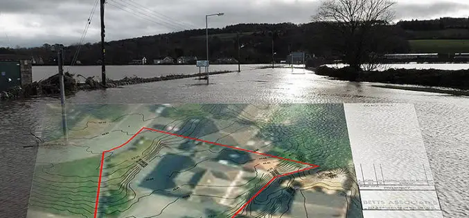
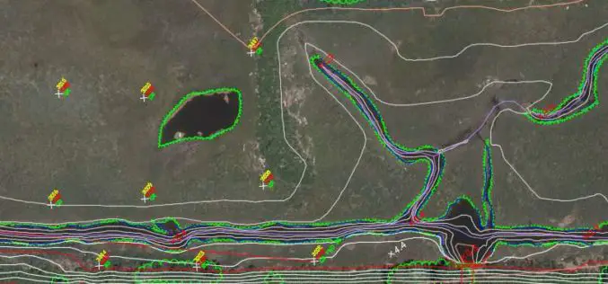
Bluesky’s 3D Aerial Maps Inform Flood Risk Assessments for Planning Applications
Aerial photography and detailed 3D height models are being used to assess the risk of flooding, and help development projects progress through the planning process. Working with Betts Hydro, part
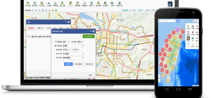
Geospatial Data in Taiwan – Focus on Integration
Supergeo’s biggest application customer in Taiwan, Ministry of the Interior and the TGOS platform, has just announced one of the biggest projects in the GIS field from ide@ Taiwan 2020
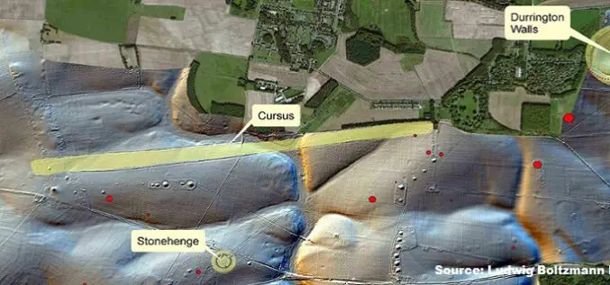
Geospatial Technology Helps To Find Remains of Major New Prehistoric Stone Monument
A team of researchers has found the remains of a major new prehistoric stone monument. They have been discovered less than 3 kilometres from Stonehenge. Using cutting edge, multi-sensor technologies

SimActive Provides Integrated LiDAR and Photo Solution to Altoa
SimActive Inc., a world-leading developer of photogrammetry software, is pleased to announce the purchase of its Correlator3D™ software by Altoa from French Guiana. The software will be used to process

PPT-Aerial Imagery By David Davis, USDA Farm Service Agency, Aerial Photography Field Office
This PPt gives an historical and present overview of how Aerial Photogrammery has changed. Written by: David Davis, USDA Farm Service Agency, Aerial Photography Field Office Download PPT-Aerial Imagery By David Davis
Qatar University Begins Digital Archiving
In a recent news by Gulf Times, Remote Sensing and Geographic Information Systems (GIS) Unit in the Environmental Studies Centre (ESC) at Qatar University has initiated the course of action to digitally
