
Tag "Aerial Data"

Business
DroneDeploy Launches Real-Time Mapping for Instant Aerial Data and Analysis
Live Map Creates Instant Drone Maps on iOS Devices, Allowing Decision-Makers to Take Immediate Action SAN FRANCISCO – February 15, 2018 – (BUSINESS WIRE)–DroneDeploy, the leading drone mapping software platform in the
Business
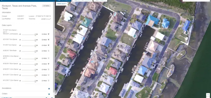
New Airbus Aerial Technology Impacts Hurricane Irma Recovery Efforts
September 12, 2017 – As residents and insurers in the southeastern United States begin to consider recovery efforts following Hurricane Irma, Airbus Aerial is prepared to help by providing insurance

GIS
Photogrammetry
Remote Sensing
UAV System Allows GIS Professionals A Cost-effective Solution for Aerial Data
CALGARY, Alberta, Aug. 23, 2013 /CNW/ – Integrated Informatics Inc. now offers a complete aerial data solution, from data capture to analysis and data management, using senseFly’s eBee unmanned aerial
