
Tag "3D"
Golden Software Releases Preview of Enhanced Scientific Graphing Package
GOLDEN, Colorado, 15 October 2018 – Golden Software, a developer of affordable software for data visualization and analysis, has released Grapher Preview, an application that allows users of the Grapher

Most Common Business Uses of Photogrammetry
Contributed by – Photogrammetry is the use of photography in surveying and mapping. It’s used to measure distances between objects, and photogrammetry software can utilize images to create 3D renderings.

3D Laser Mapping & GeoSLAM Global Merger Announcement
3D Laser Mapping Ltd and GeoSLAM Ltd Merge, Creating a Global Market Leader in Mapping and Monitoring Nottingham, England, 1st August 2018 – Leading UK laser scanning and monitoring companies’ 3D

A City in 2 Billion Points
July 31, 2018 – In 2014 the Institut Cartogràfic i Geològic de Catalunya (ICGC) scanned an area of 1900×1200 meters around the La Sagrada Família in the city of Barcelona using
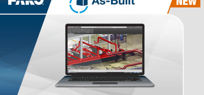
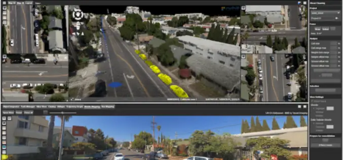
FARO® Introduces As-Built™ Software Platform For 3D Digital Modeling
Enables More Efficient and Cost-Effective Reality Capture into Autodesk® Design Tools Lake Mary, FL, May 24, 2018 – FARO® (NASDAQ:FARO), the world’s most trusted source for 3D measurement and imaging solutions for
Skyline Software Systems Releases Photomesh™ 7.4 With LiDAR Integration and Improved Aerial Triangulation Capability
Herndon, VA – May 21, 2018 – Skyline Software Systems Inc. announced today that it has released PhotoMesh™ v7.4 software suite as part of its SkylineGlobe products. This update integrates

Vricon Unveils New Solution: Vricon Precision 3D Registration (P3DR)
Precise, accurate, georegistered GEOINT data for analytics and visualization—at a global scale McLean, Virginia, April 23, 2018 (GLOBE NEWSWIRE) — Vricon is pleased to announce that it is unveiling the
GeoSLAM to Demo Time & Cost Saving 3D Mobile Laser Scanners for Construction Applications at 2018 AGC Convention
NOTTINGHAMSHIRE, U.K., 20 February 2018 – GeoSLAM will demonstrate how its ZEB-REVO RT handheld laser scanner can be used to slash the time and cost required for complex indoor 3D mapping on

Global Mapper v19.1 Now Available
Global Mapper v19.1 Now Available with 3D Profile Line Exporting, Multivariate Querying, and Expanded Drag-and-Drop Window Docking Blue Marble Geographics is pleased to announce the release of Global Mapper version
Orbit GT Releases 3D Mapping Content Manager V18
Jan. 30, 2018 – Orbit GT is happy to release the new 3D Mapping Content Manager v18. “The Content Manager is arguably the most unique yet extremely powerful product in our
