
Tag "3D elevation data"
GIS
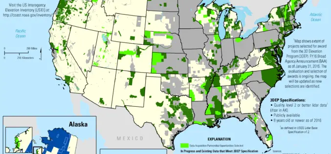
2016 Lidar Partnership Awards Announced
The U.S. Geological Survey has announced the first recipients of the 2016 partnership funding awards for the 3D Elevation Program. This program, referred to as 3DEP, presents a unique opportunity
GIS
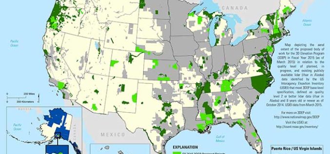
State and Regional 3DEP Stakeholder Workshops Underway
The U.S. Geological Survey National Geospatial Program is developing the 3D Elevation Program (3DEP) to respond to growing needs for high-quality topographic data and for a wide range of other
