
Tag "3D earth"
Managing Assets from Different Angles- SuperGIS 3D Earth Server
3D visualization is an important breakthrough in how geographic data could be displayed on the computer. Instead of the traditional 2D form, SuperGIS 3D Earth Server can easily present data
Meet HTML5 and the 3D Earth
HTML5 is the latest HyperText Markup Language of the World Wide Web Consortium (W3C), which was first published in 2008. However, it was released and has been used since 2011
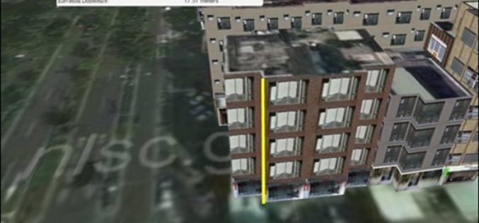
Underground Utilities and Traffic Applications in 3D
SuperGIS 3D Earth Server is now focusing on the development of underground utilities and traffic applications. The product not only provides the ability to visualize and manage underground utilities in
Geological Survey of Israel Chooses SuperGIS Desktop
Supergeo Technologies Inc. announces that the Geological Survey of Israel utilizes SuperGIS Desktop and extensions such as Spatial Analyst, Spatial Statistics Analyst and 3D Analyst, to enhance the efficiency of

SuperGIS 3D Earth Server Updates with Stronger Functionality
Supergeo Technologies, the global leading GIS software and solution provider, releases the latest SuperGIS 3D Earth Server 3.2 with diverse enhancements and structure modifications to elevate user experience of 3D
