SuperSurv 3.2 Release Advanced GPS Support and Data Collection Functions
 Developed by Supergeo, the latest version of SuperSurv (Android) 3.2 is upgraded with stronger data collecting function by GPS and more precise and easy-to-use GPS manipulation interface, bringing more convenient and intuitive user experience.
SuperSurv is an efficient mobile GIS app designed for field data collection on iOS and Android platforms. The GIS app not only supports users to collect spatial and attribute data, but also provides attribute query, tracklog recording and display, adding Waypoint, etc.
Integrating with GIS and GPS technologies, SuperSurv provides useful functions like Map Display, Query, Measure, etc., and supports to overlay OpenStreetMap as the basemap. Also, users may capture point, line and polygon features and attribute data, and save the data as SHP or GEO format in both offline and online modes.
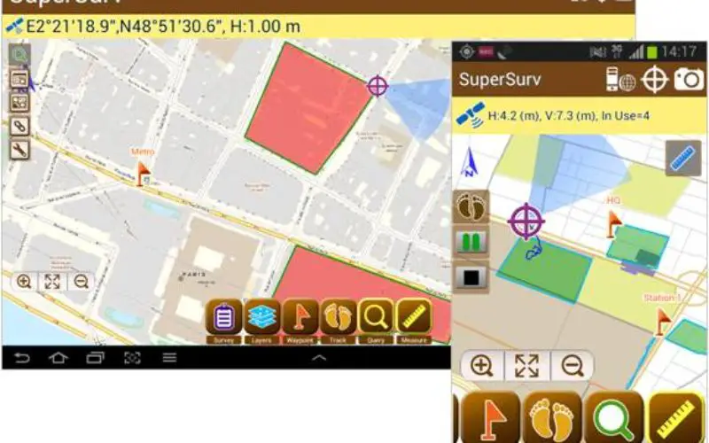
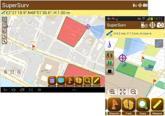
According to Supergeo, the new SuperSurv 3.2 has enhanced GPS status bar to show the positioning information with more details like Horizontal Accuracy, Vertical Accuracy and Current Satellite Numbers. Moreover, data collecting function with GPS has been strengthened to provide better positioning efficacy and more accurate data collect settings.
One of the most important inclusions in the new release is the real-time NMEA information for advanced usage, which allows SuperSurv 3.2 users to view or save the GPS records correctly.
To download newest SuperSurv 3.2 free trial
AppStore: https://itunes.apple.com/us/app/supersurv/id734191604?mt=8
GooglePlay: https://play.google.com/store/apps/details?id=com.supergeo.asd.supersurv_lite.SuperSurv
Learn More about SuperSurv 3.2: http://www.supergeotek.com/ProductPage_SuperSurv.aspx
# # #
About Supergeo
Supergeo Technologies Inc. is a leading global provider of GIS software and solutions. Since the establishment, Supergeo has been dedicated to providing state-of-the-art geospatial technologies and comprehensive services for customers around the world. It is our vision to help users utilize geospatial technologies to create a better world.
Supergeo software and applications have been spread over the world to be the backbone of the world’s mapping and spatial analysis. Supergeo is the professional GIS vendor, providing GIS-related users with complete GIS solutions for desktop, mobile, server, and Internet platforms.
Marketing Contact:
Patty Chen
Supergeo Technologies Inc.
5F, No. 71, Sec. 1, Zhouzi St., Taipei, 114, TAIWAN
TEL:+886-2-2659 1899
Website: http://www.supergeotek.com
Email: patty@supergeotek.com